San Diego to Sonoma, CA | 837.5 mi | 53 days | Completed 11/13/2012
Day 38 - Carpinteria to Mission San Buenaventura
DAY 38 — Tuesday, Oct 30, 2012
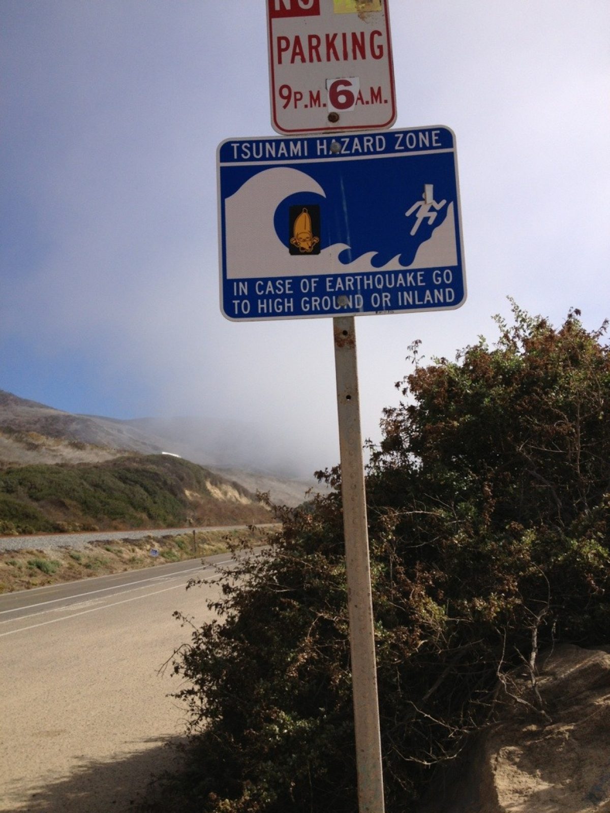
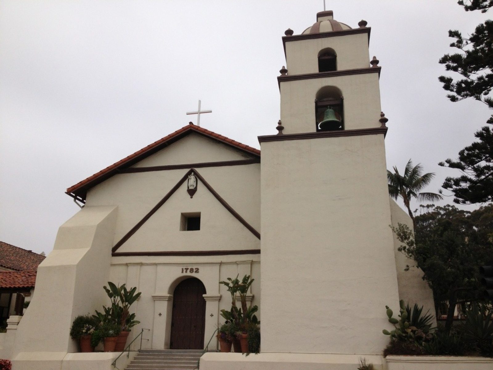
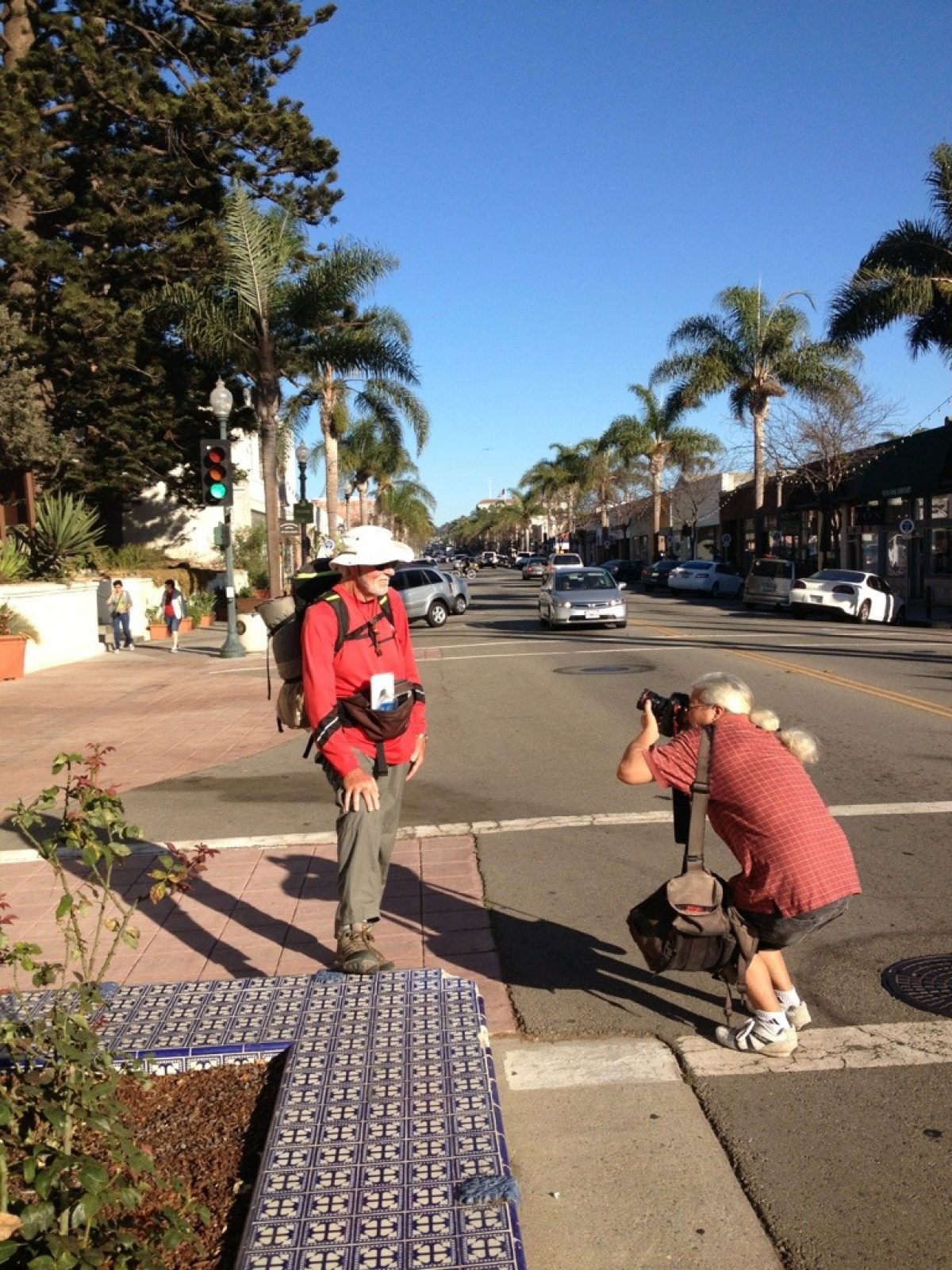
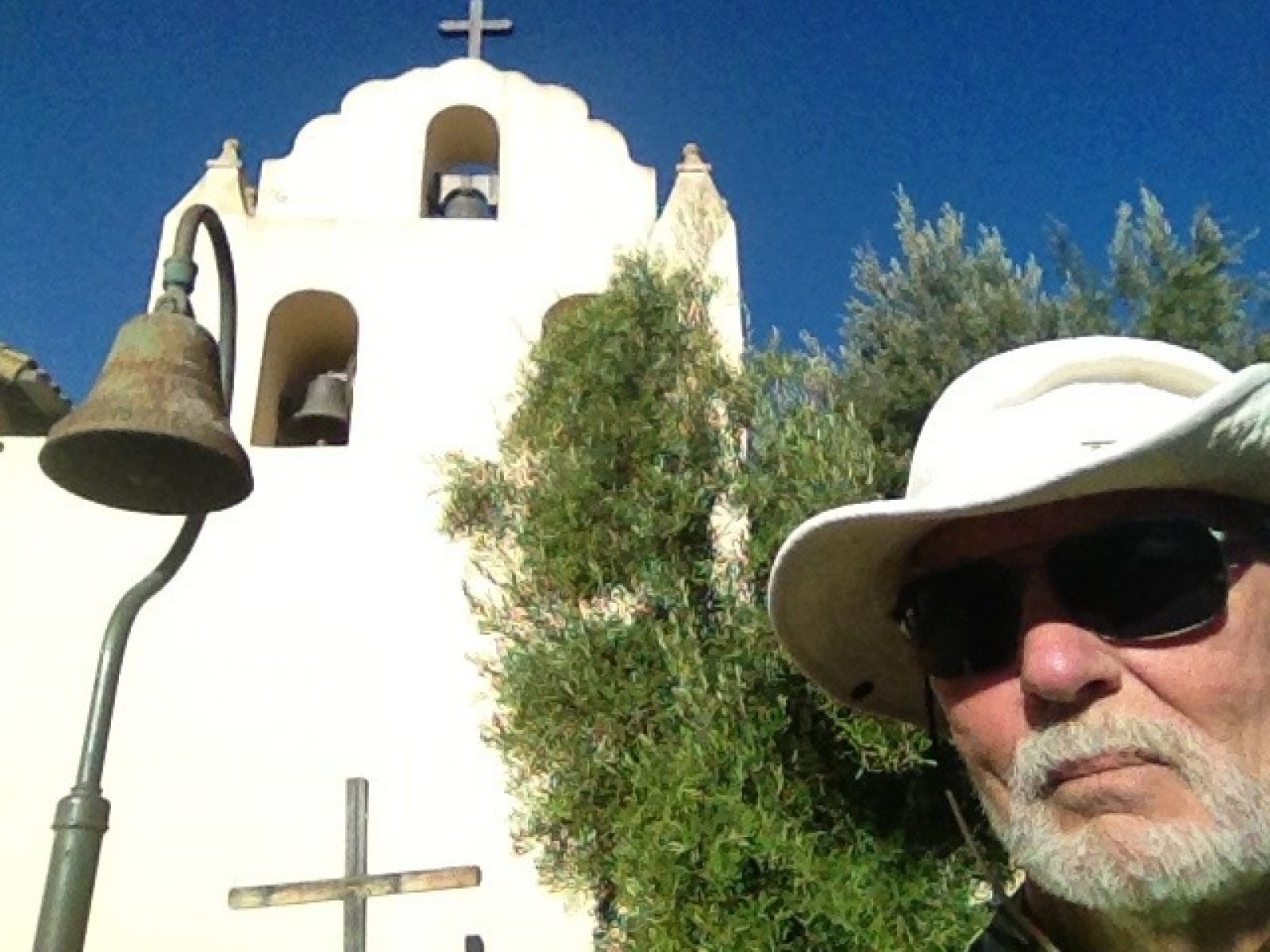
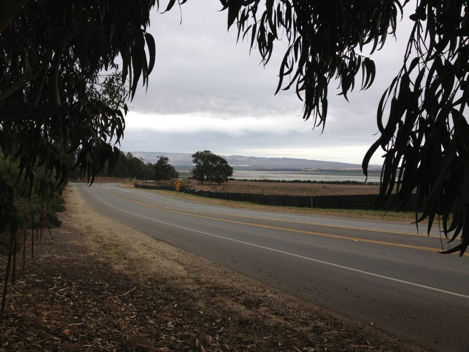
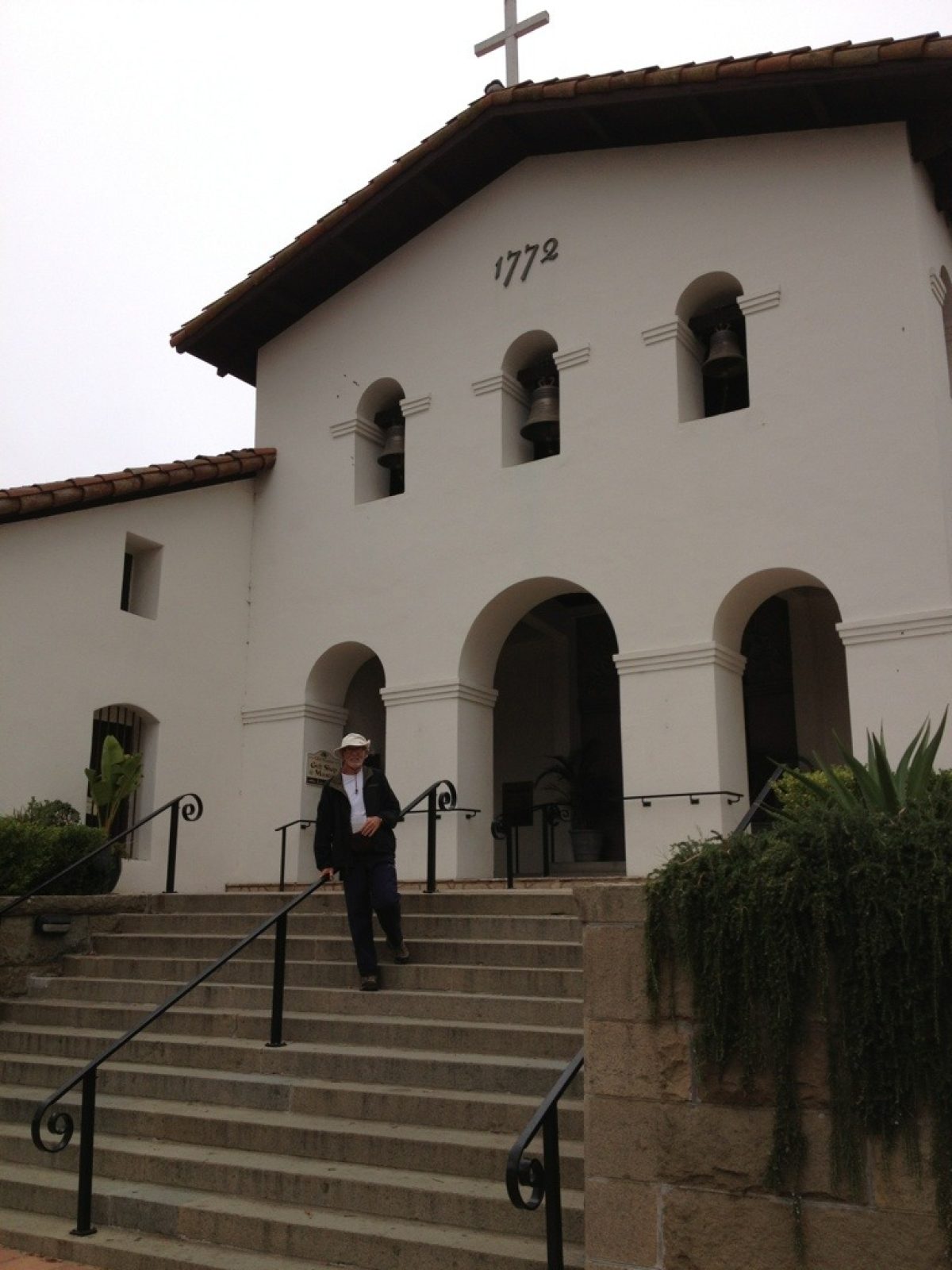
The 18-mile walk started after "home shuttle service" dropped me off at Carpinteria, of course after devouring a huge breakfast and packing lots of lunch food. After leaving Carpinteria, I found myself walking on the shoulder of 101--noisy but adequately shouldered. Once on the old Pacific Coast Highway (PCH), the walk became a pleasant walk along the beach front. Strange to be walking along a "tsunami hazard zone"--bet Juan Bautista de Anza had no idea of that hazard! The photographer from the Ventura County Star met me about a mile out from the mission and started shooting away. To my surprise nearly thirty hometown friends made an appearance at the mission at about 4:30pm to congratulate me on this 16th milestone (with only 5 more missions to go). It truly warmed my heart to see the support. Hanna, reporter from the Ventura County Star Newspaper interviewed me and then a group of ten of us finished the event at Yolies with some good Mexican food and drink--a real fun occasion. Particularly noteworthy about the mission is that it was the ninth and last to be founded by Father Serra (March 31, 1782). Like so many other missions, earthquakes, fires, and other disasters have necessitated numerous reconstructions of the church itself. It matters little how close or far what we see today corresponds to what existed early on--it's a joy to feel the history! Here are a few photos along the way:
Day 37 - Santa Barbara to their Mission and on to Carpinteria
DAY 37 — Monday, Oct 29, 2012
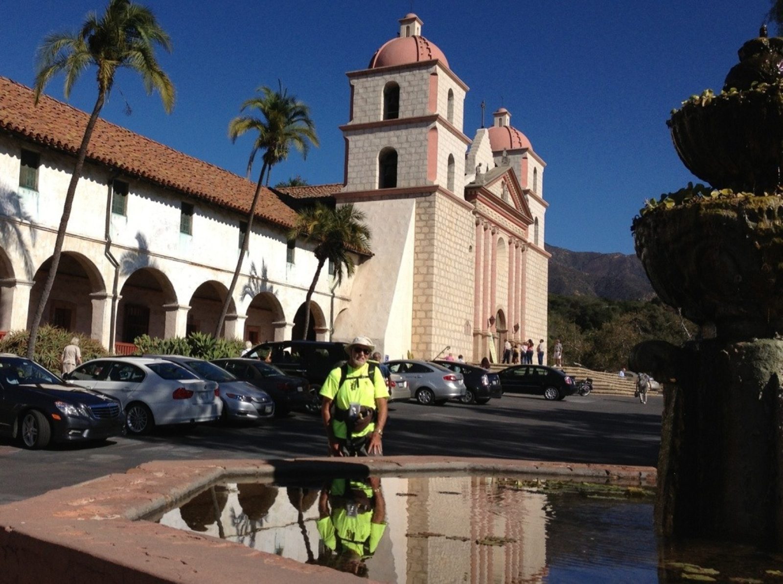
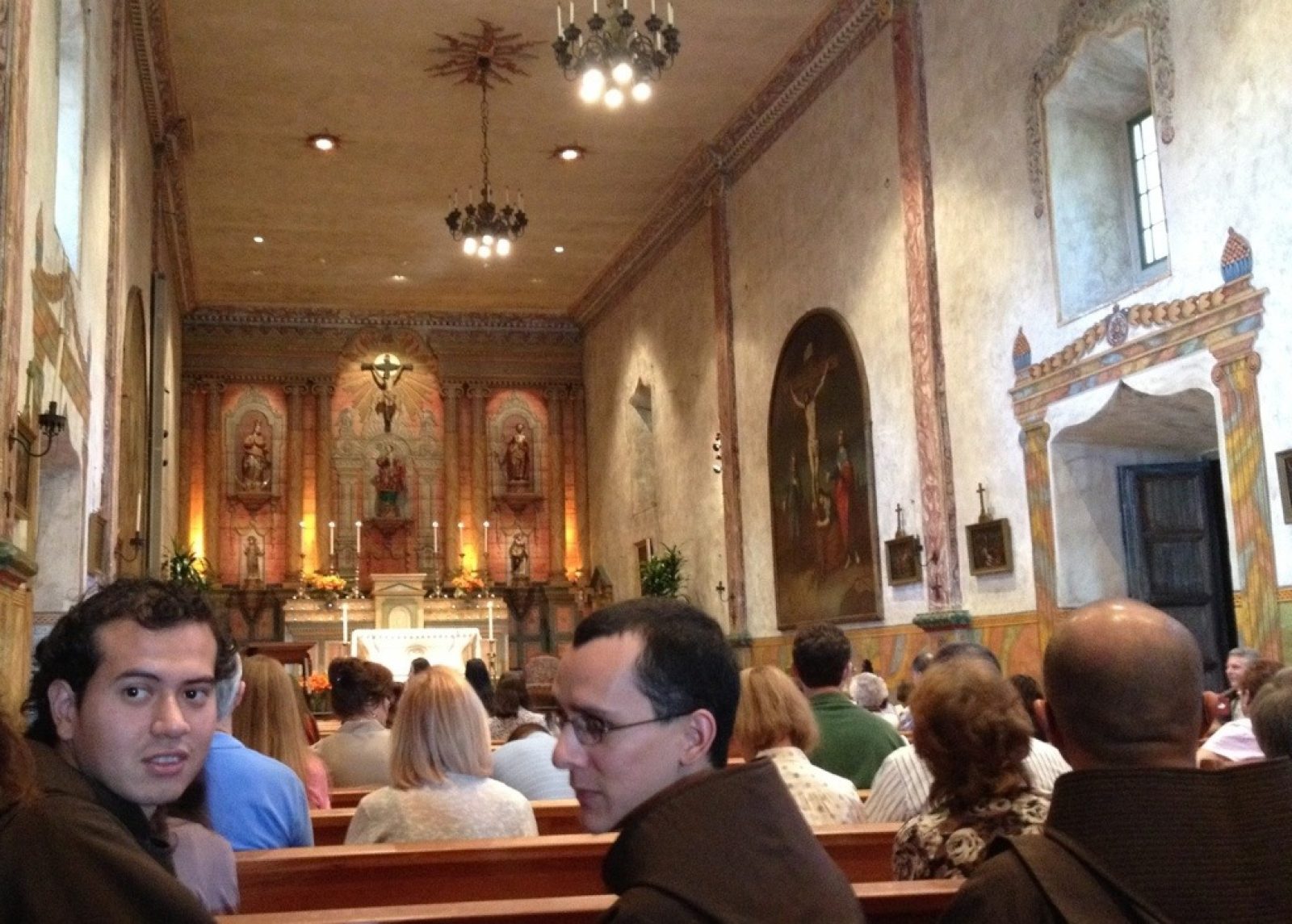
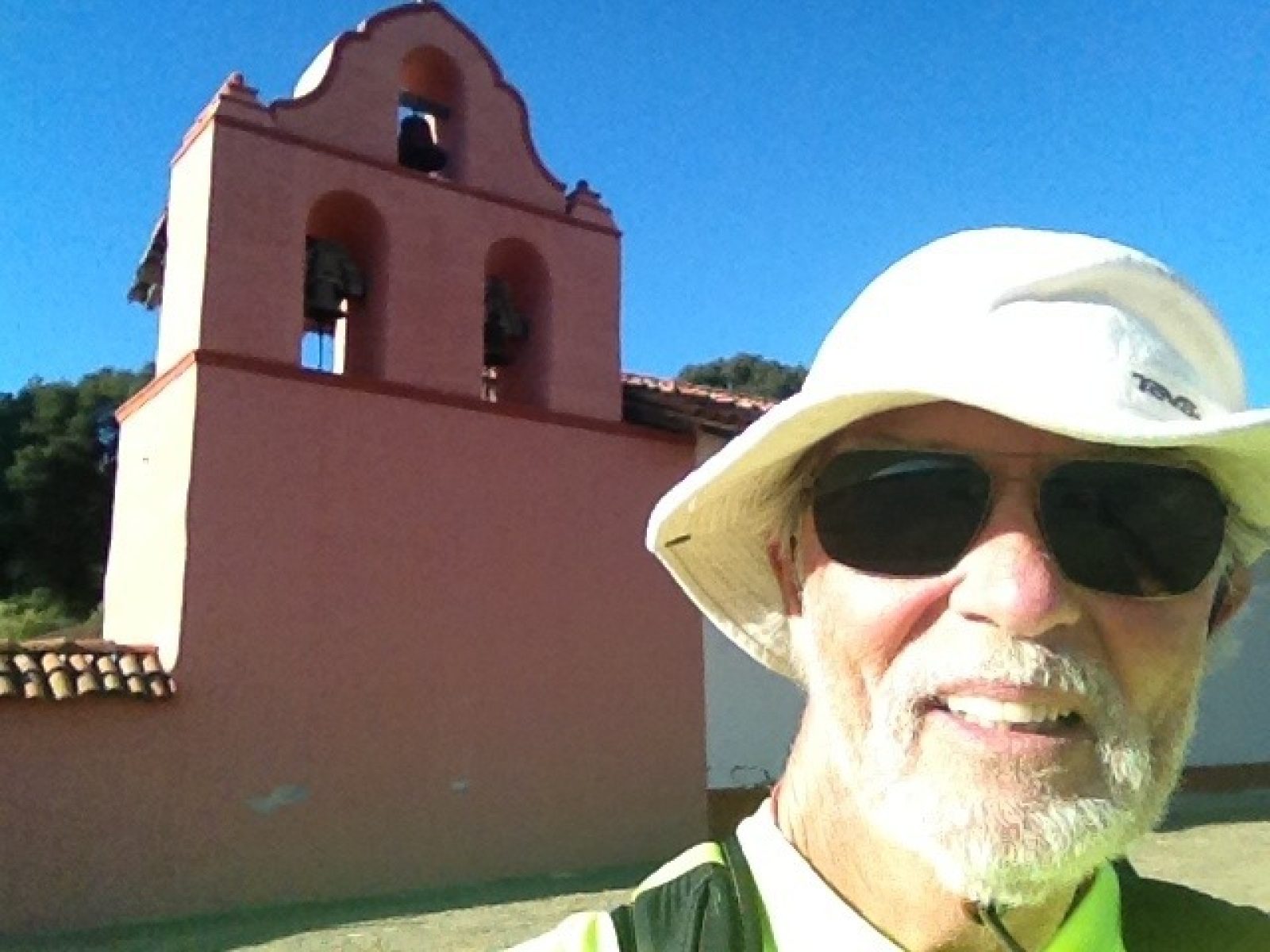
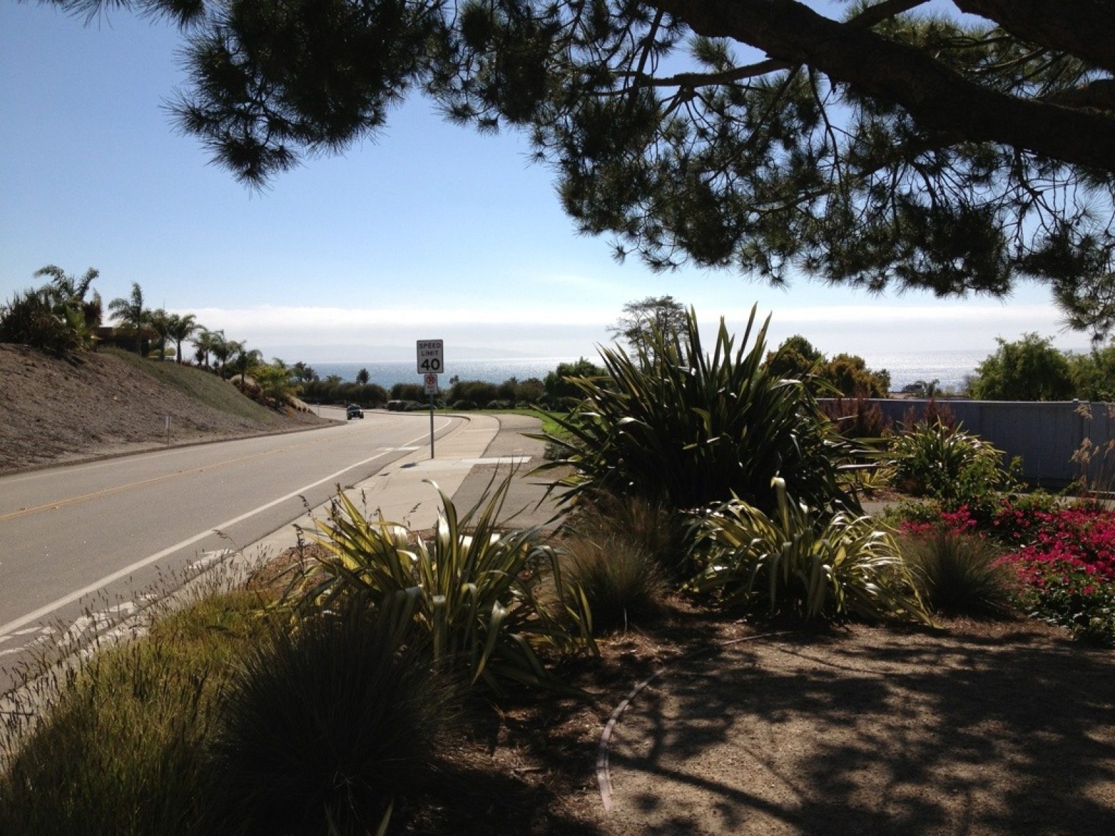
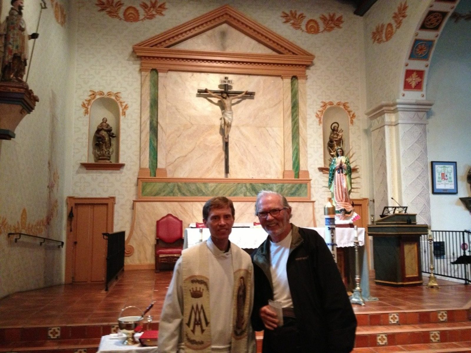
When I came down from the San Marcos Pass, Lucille (our family friend) picked me up and coddled me for the evening (hot shower, great home-cooked meal and a comfy bed) and gave me a send-off with a hot breakfast, sandwiches, and snacks for later. A short, six-mile walk later had me meeting Father Charles at the Mission Santa Barbara. He was about to start mass, but took time out to give me a special blessing and wished me well in my adventure to see the remaining 6 missions! Honestly, it was the warmest welcome thus far. Santa Barbara Mission was founded Dec 4th, 1786 (10th in order). The mission's nickname is "Queen of the Missions" because of its beautiful exterior--the only one with two towers. I've attached two photos. The rest of the journey (another 13 miles, making a total of 19 miles), headed through the city of Santa Barbara down to the beach then along frontage roads to Carpinteria. "Home shuttle service" picked me up for a special night at home and will take me back to Carpinteria tomorrow a.m.
Day 36 - Lake Cashuma Rec Area to Santa Barbara
DAY 36 — Sunday, Oct 28, 2012
Spent a night getting reacquainted with my tent at Lake Cashuma Campgrounds. The area is quite pretty and the camp store served me well the night before in helping me quench my thirst.
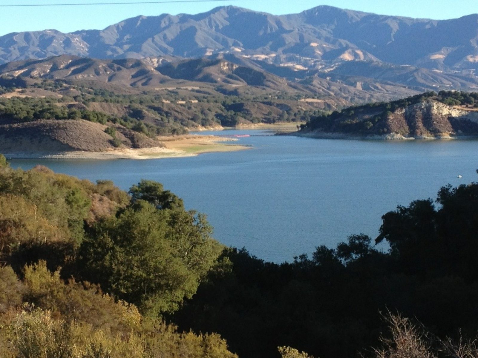
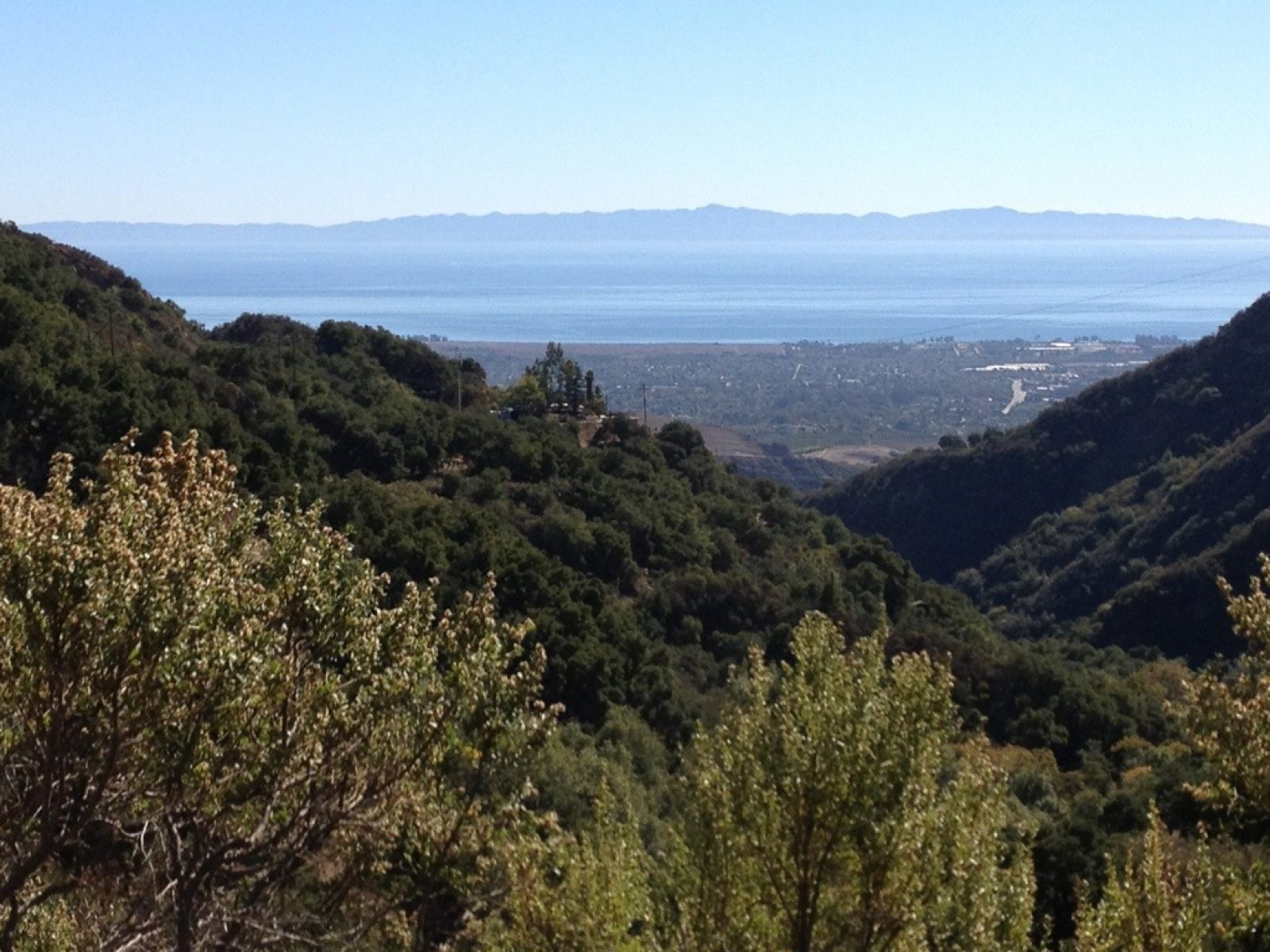
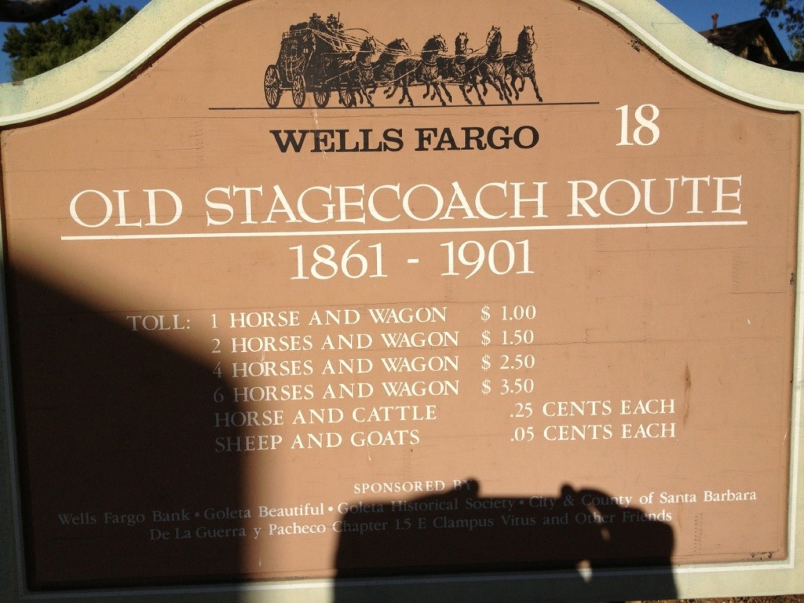
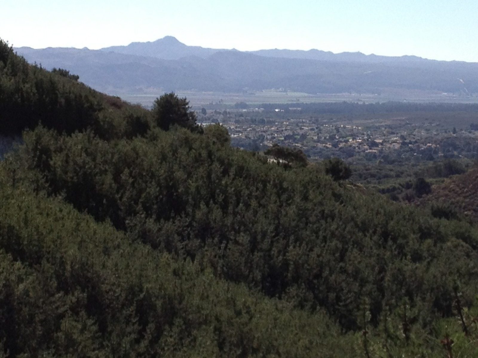
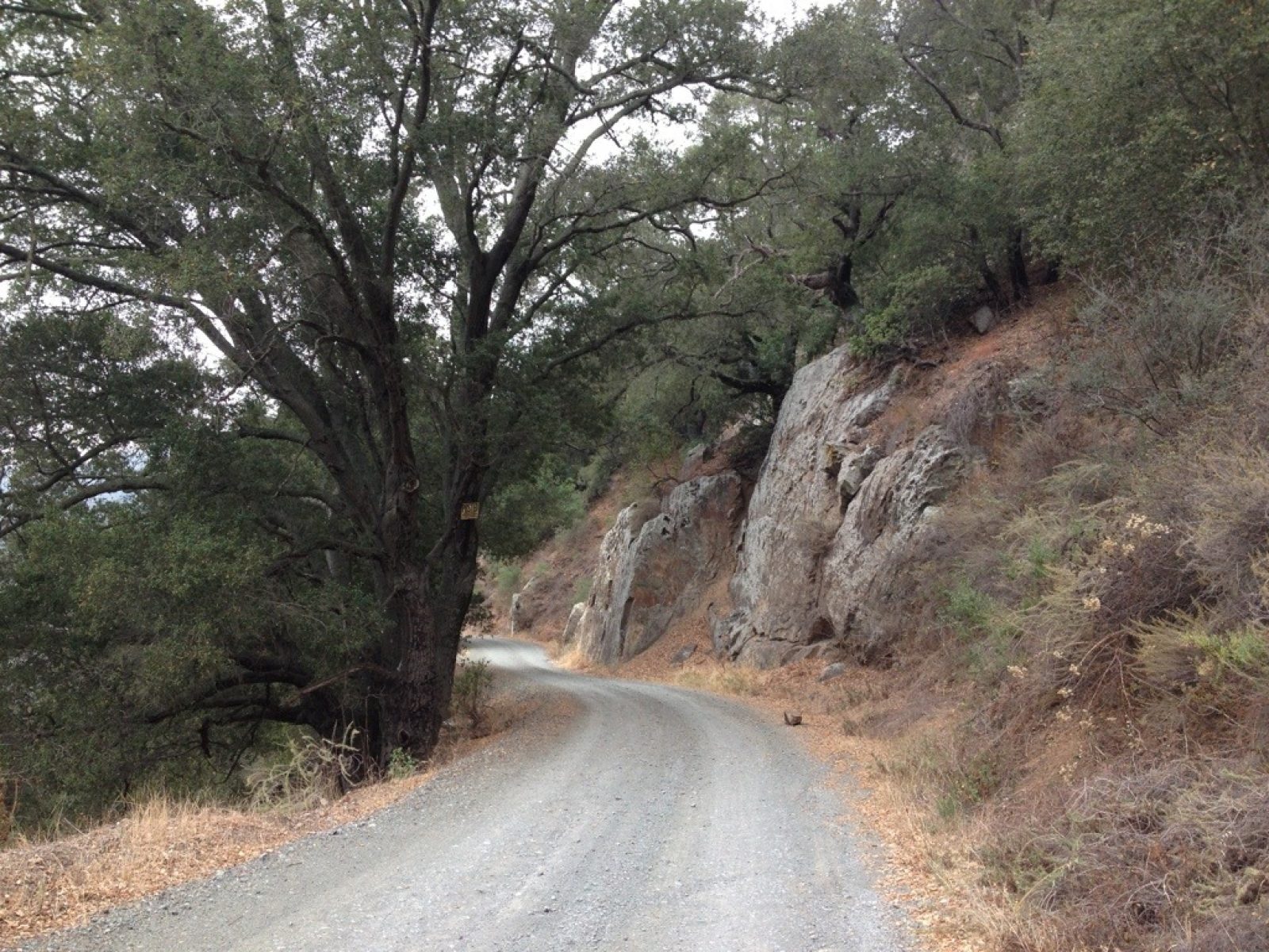
The first five hours were a steady climb up the San Marcos Pass along route 154 (2700-foot climb in all). I might add with an extremely skimpy shoulder one needs great vigilance. Once at the top, I walked along 154 some more, but then turned onto the old San Marcos Road, which has its history linked to the stage coach route. Check out these pictures first of lake Cachuma and then the view of Santa Rosa channel island as I walked on the old San Marcos Road.
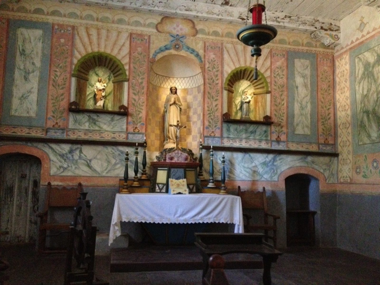
Day 35 - Buellton to Mission Santa Ines and on
DAY 35 — Saturday, Oct 27, 2012
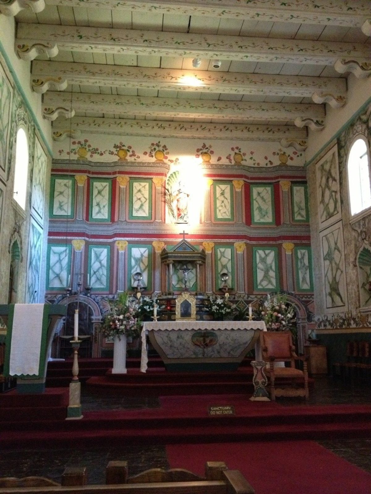
Really short day so far up to Mission Santa Ines (Saint Agnes), and a warm welcome by the volunteer staff and one of the Franciscan priests. An early post in case I find myself without service at the Cachuma Rec Area tonight.
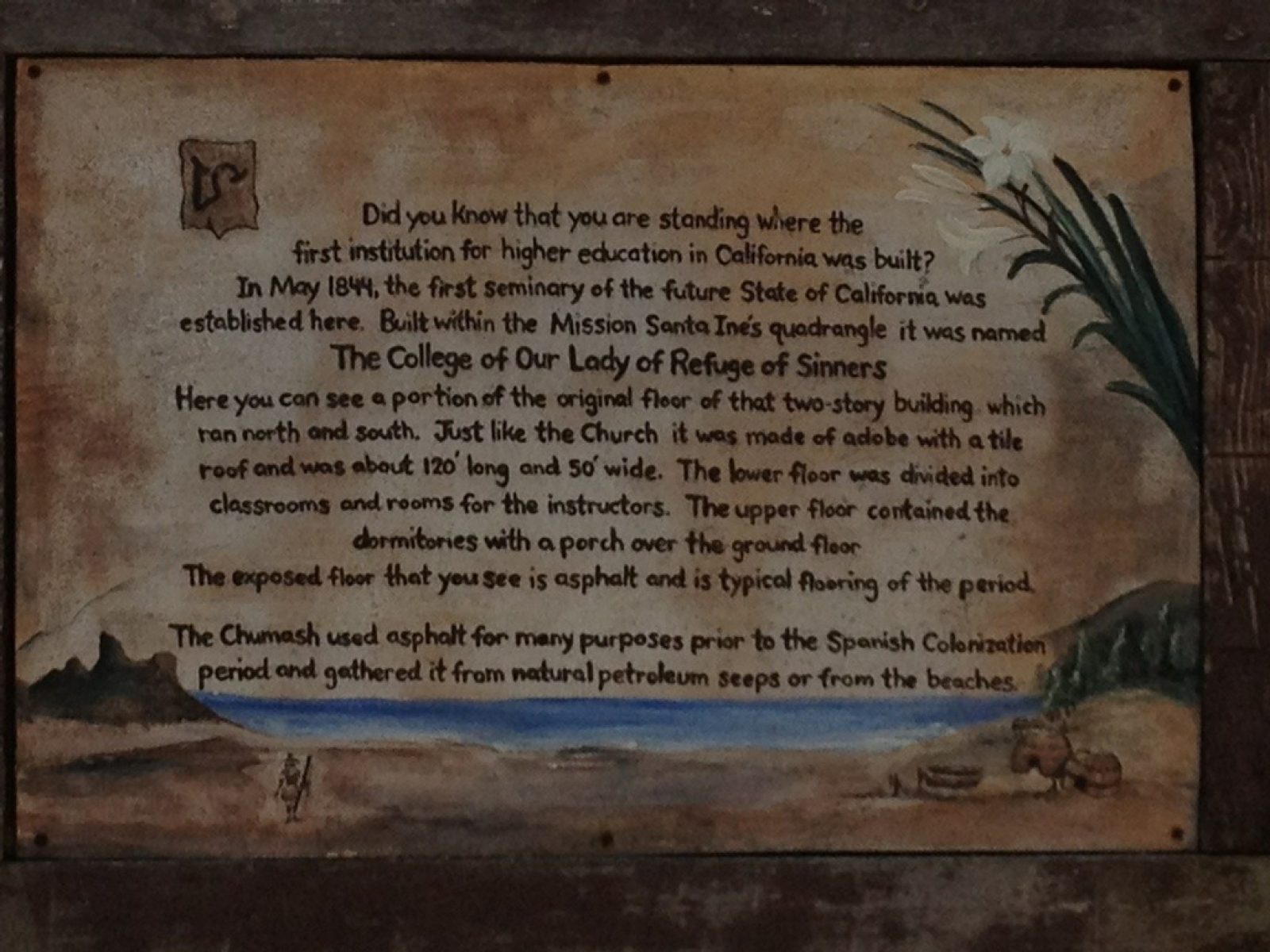
The church had an audio tour one could activate by pushing buttons within the church--well done. In stark contrast to Mission la Purisima, Mission Santa Ines is warm and befitting a venue still used for mass. BTW, a marker in the garden tells of this location as the first place of higher education within California. Here are several pics:
Day 34 - Mission La Purisima/Lompoc to Buellton
DAY 34 — Friday, Oct 26, 2012
The early parts of my 19.5-mile walk had me looking directly into the bright sun--I was walking to east climbing out of the Lompoc Valley into the Santa Ynez Valley. I was observing an amazingly interesting phenomenon: nearly all mountain ranges on the North American Continent run north-south--not this one! Of course, it wasn't always that way. Some 12 million years ago it was orderly, then rotated 110 deg clockwise and thus we end up with a beautiful traverse range some 70 miles long that stretches from where Point Concepcion meets the Pacific all the way to Ojai! What's more it's a single-crested range with "phenomenal" character. It also screws most of us up who live in its shadows, because when we look out into the ocean, we're looking south (not west).
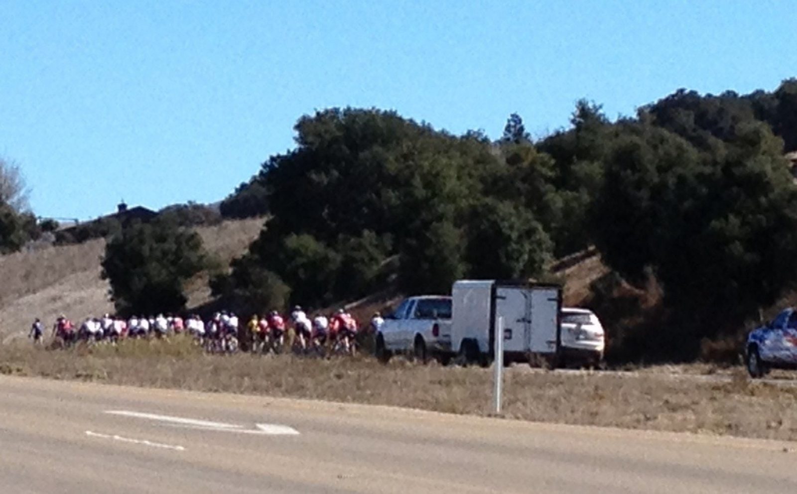
Besides seeing an increasing number of vineyards, I noted a few sites unique to this part of the country: Chumash Indian Casino buses making their runs to Lompoc (the Casino is just east of Solvang); black/raspberries enshrouded in plastic to avoid the birds' damage; and at least three bicycle groups with guide motorcycles and support vehicles. It was a fun day, as all of them have been!
Day 33 - Addendum Going Orcutt to Mission La Purisima
DAY 33 — Friday, Oct 26, 2012
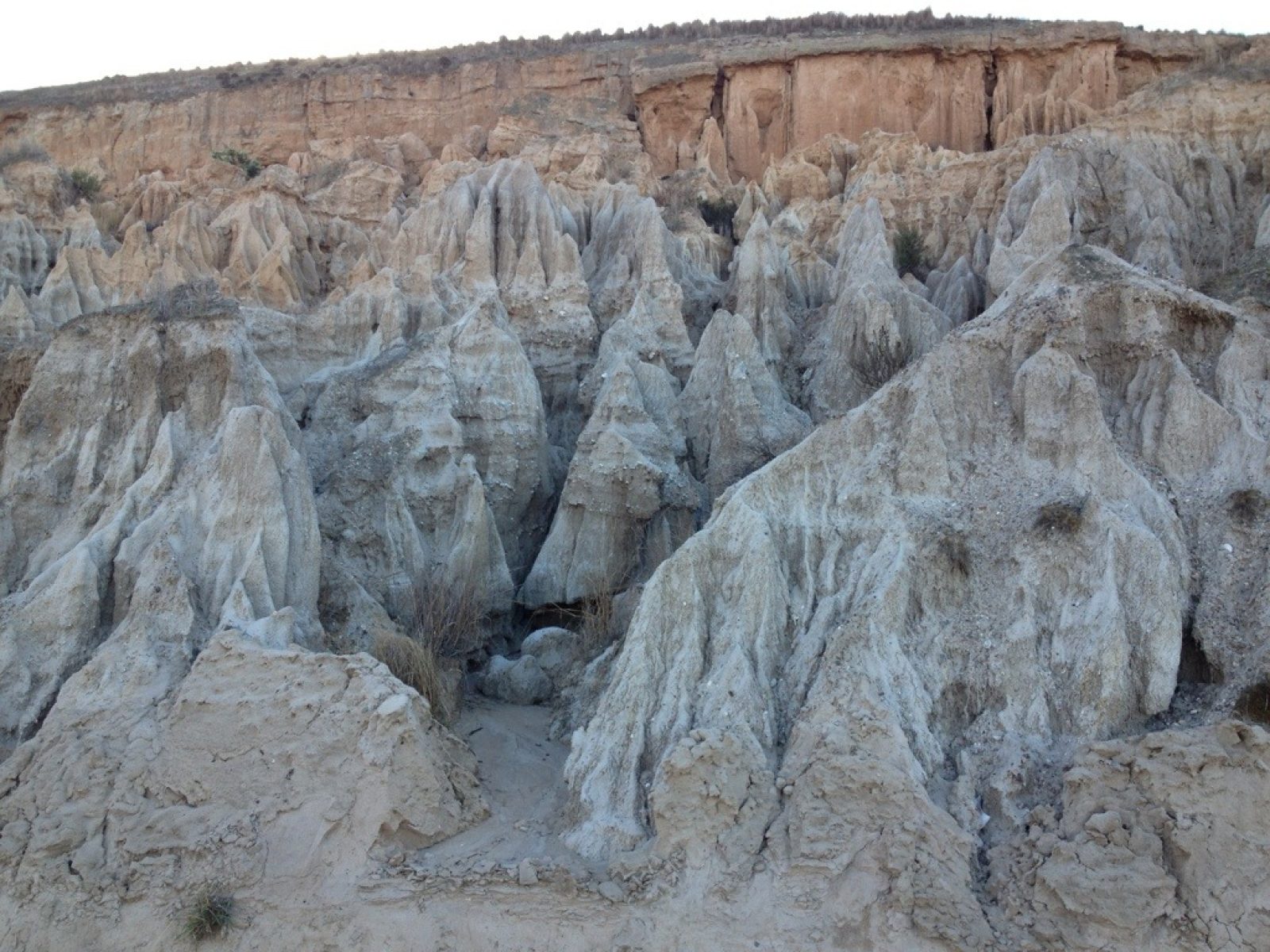
I meant to add this photo of a stretch of the walk because it so reminded me of Cappadocia, Turkey, the venue of my novel, Storm over Cappadocia. Although the scale of these structures is much smaller, the same kinds of erosion effects have taken place--awesome!
Day 33 - Orcutt to Mission La Purisima
DAY 33 — Thursday, Oct 25, 2012
I started today's journey riding the bus some 30 minutes along with students going to their schools that seemed a long way from their home. We headed south from Santa Maria to Orcutt. On the trail, it was a gentle climb until I found myself on the legendary Harris Grade Road which, in fact, used to be the old PCH--Route 1. It connects the Los Alamos Valley with the Lompoc Valley and is so dangerous in terms of sharp and blind curves and numerous switchbacks, that Santa Barbara County voted in 2010 to ban all semis / trucks longer than 30 feet. To avoid the blind curves, I had to switch sides of the road numerous times.
The pluses of the Harris Grade Road are stunning panoramic views of Lompoc valley, passing through a 100-year old oil field, and seeing rare Bishop pines who release their seeds only during a forest fire!
Arriving at Mission La Purisima, I was reminded that the California State Parks manages this mission, the only other one being my first one, Mission Solano. It was the 11th mission founded (Dec 8, 1787 by Padre Lasuen). See the enclosed pics.
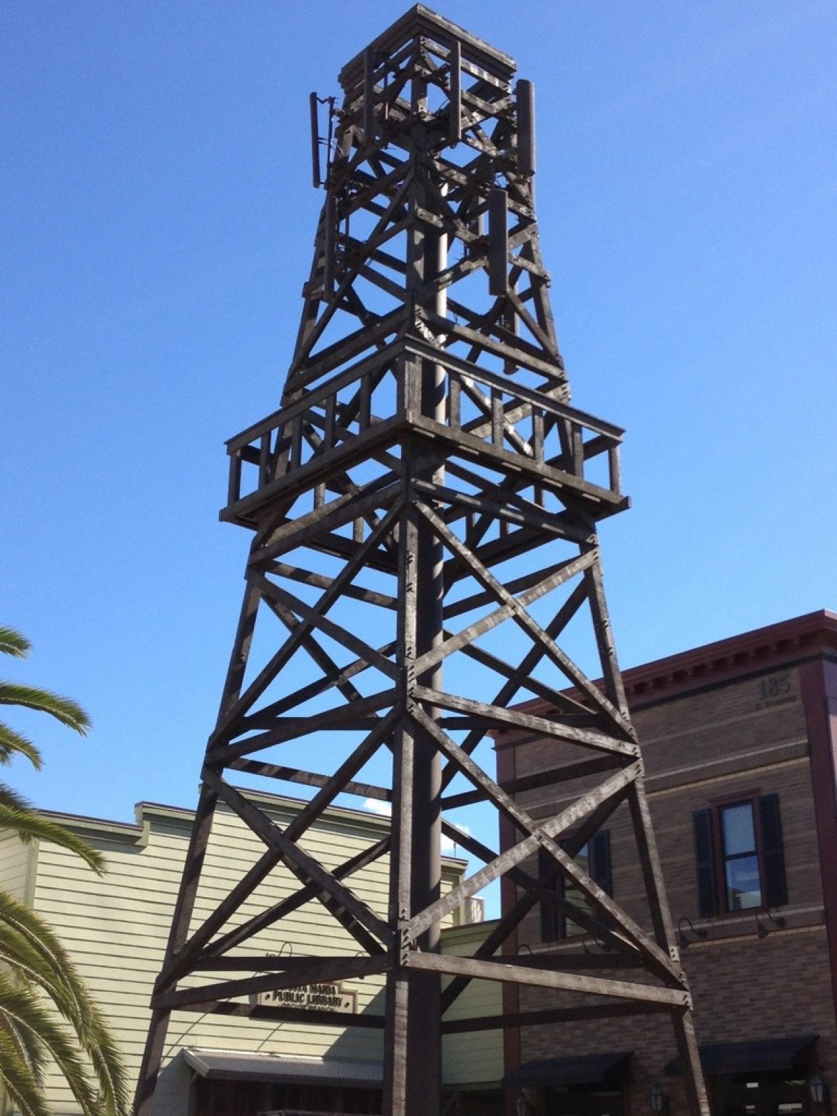
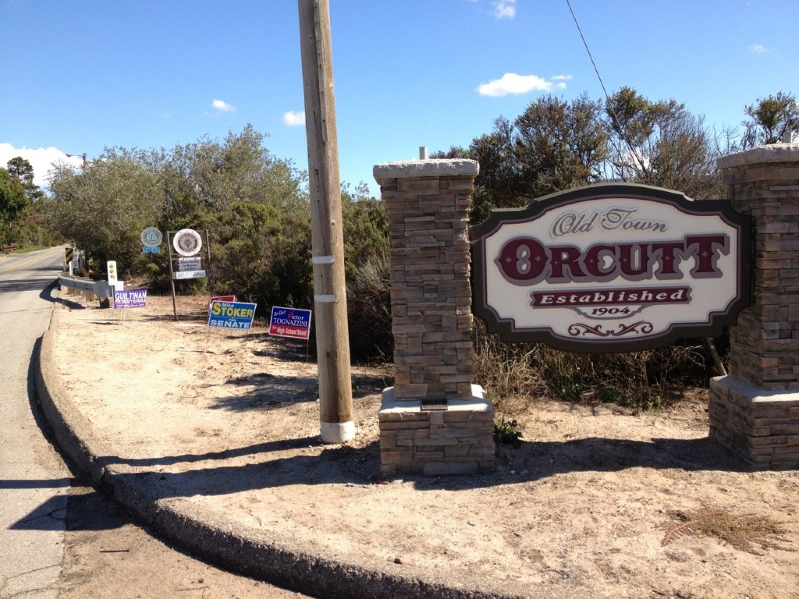
Day 32 - Guadalupe to Orcutt
DAY 32 — Wednesday, Oct 24, 2012
Today's 12.5 mi followed more of the Juan Bautista de Anza Trail paralleling the Santa Lucia mountains, which by now are more properly "hills." A huge breakfast, a short walk, a half of a backpack (the other half staid at the motel), and a praline malt at Orcutt's Doc Burnstein's Ice Cream Lab made for a hugely successful day. I am ready to bus down to Orcutt in the morning and walk the 22+ miles to my 13th mission, La Purissima.
Old town Orcutt was the highlight of the day, starting with the faux water tower to house cell-phone antennas--mighty clever, as they said in the old days (check out the pic). The town is trying to project that 1904 flavor when it was established. It was named after the Union Oil Company "dean of petroleum geologist" William Warren Orcutt who BTW discovered fossils in the La Brea Tar Pits! The town was founded as a boom town riding the success of the oil production going on in the early 1900s. Orcutt was assigned to survey the area; his findings urged Union Oil to be aggressive which in turn led to huge successes.
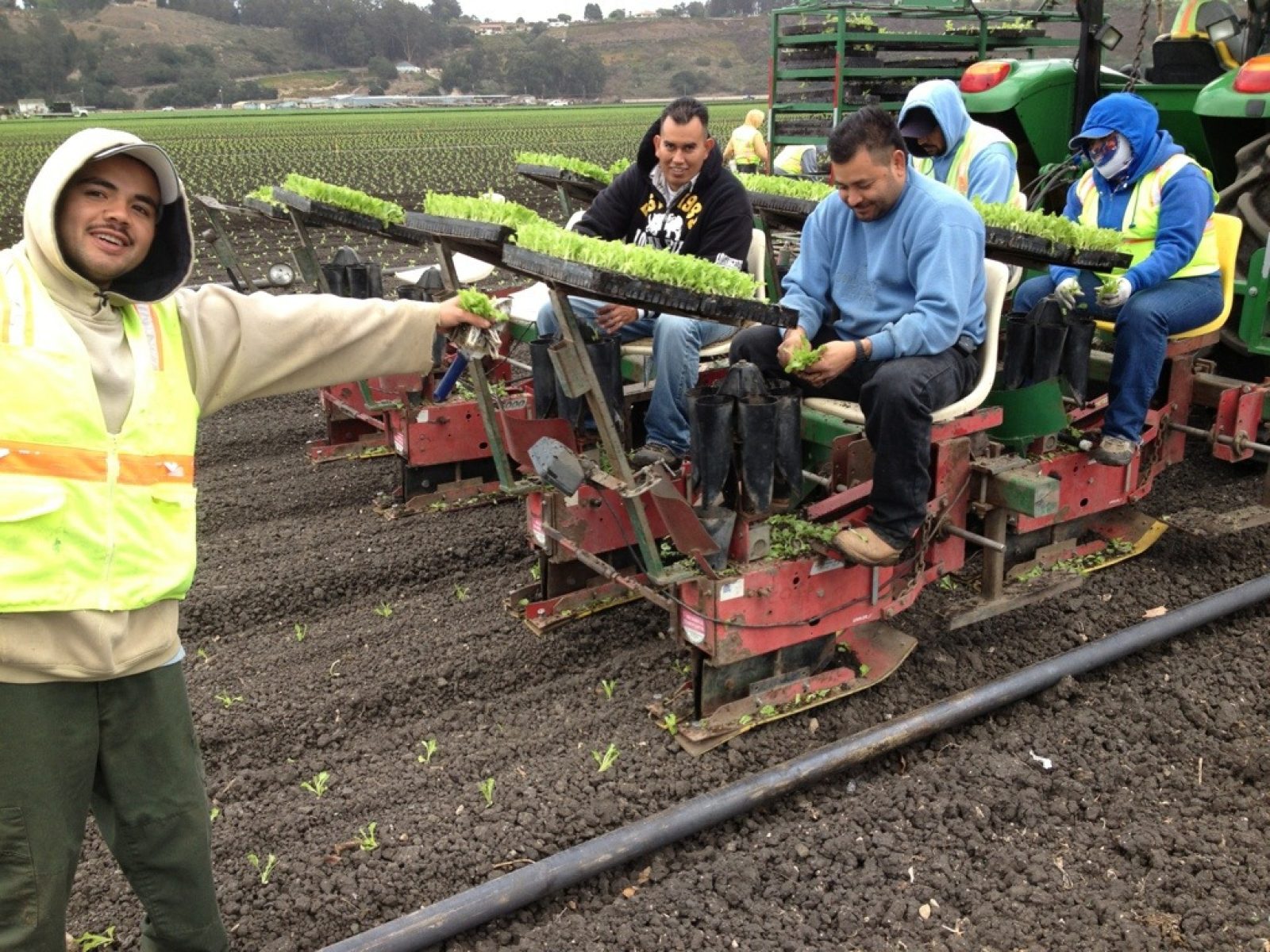
Day 31 - Oceano to Guadalupe
DAY 31 — Tuesday, Oct 23, 2012
Today's 13.3 mi. was 7.5 less than I expected--what a pleasant surprise, despite the intermittent light drizzle throughout the day! Coming out of Oceano, I gazed at the familiar vegetable fields, and couldn't resist capturing a shot of the team planting lettuce seedlings by machine. It's still a person-in-the-loop operation, but much more automated than doing it entirely by hand.
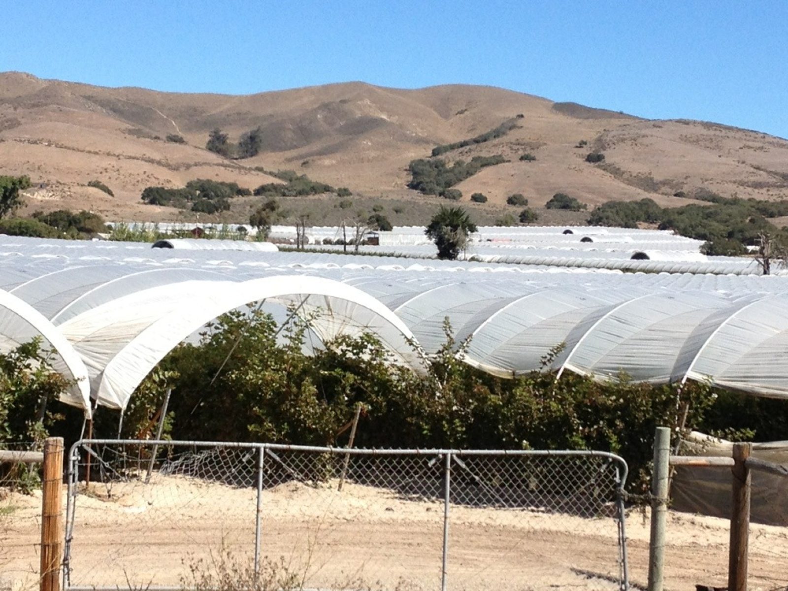
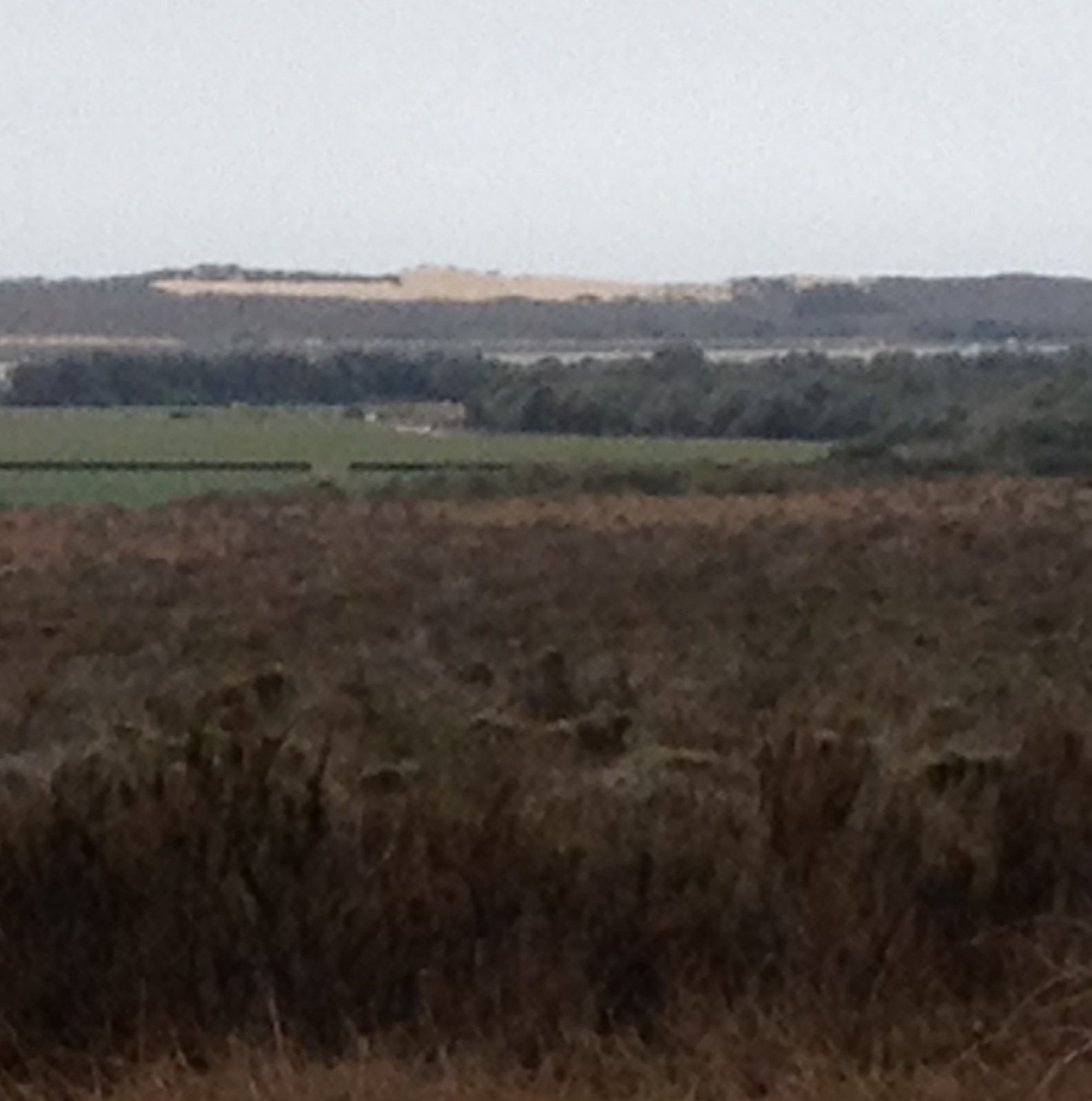
Something else that struck me as I walked the Juan Bautista de Anza Trail was that when he brought his settlers north there wasn't a single of the now ubiquitous eucalyptus trees to "greet" him. So many of my rest stops are under the shade of these tall trees. Note the picture through the eucalyptus branches where you can see an "ocean" of plastic-covered fields recently planted with strawberries. The other big attractions are the dunes off in the distance to the west. The photo doesn't do justice to their imposing expanse.
From Guadalupe I took the Flyer Bus east to Santa Maria and took a room for two nights. I'm staying in the county court house/police station area--the 2005 Michael Jackson trial comes to mind as the BIG event here 7 hears ago.
Tomorrow I'll take the bus back to Guadalupe, walk the short 10 or 12 miles to Orcutt, and take the bus north to here.
Day 30 - Mission San Luis Obispo to Oceano
DAY 30 — Monday, Oct 22, 2012
After saying goodbye to my sweetie this morning, I had a nervous feeling about the day. Could I make a nearly 16-mile day with full backpack and no safety net that she provided yesterday? My doubts weighed on me during the entire walk. Well, I did make it and am resting in the comforts of the Oceano Inn--I forewent the Oceano Campground experience tonight. The rest of the trip should proceed with greater confidence!
The slow climb out of the valley wherein San Luis Obispo is nestled ended after about nine miles at the crest of the Pismo Beach Mountains. The rewards of the climb were breathtaking views of the ocean--I'm only posting my first view. There were so many while walking a good many miles on Shell Beach Road: steep cliffs to sandy beaches and special treats are the sea stacks (hunks of rock jutting out of beach areas with erosion having removed all the material around it).
Day 29 - Santa Margarita to San Luis Obispo
DAY 29 — Sunday, Oct 21, 2012
Can't convey how elated I was for these three events: my sweetie surprised me at the hospital at 6:30 this morning; the hospital discharged me late morning, and I backtracked and completed the Cuesta Grade (11 miles; 1200 ft ascent, but 1900 descent). It tired me more than usual but the pure joy of finishing it overcame the tiredness.
Check out the picture on the Cuesta grade--so much picturesque scenery.
The mission was beautiful with a unique aspect being an add-on, if you can imagine, an entire wing nearly as large as the original church. Baptisms and other goings on in the square in front of the mission created buzz.
Day 28 - Atascadero to Santa Margarita
DAY 28 — Saturday, Oct 20, 2012
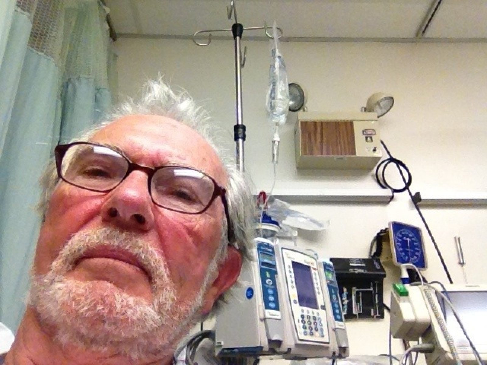
It was a push this morning from the word GO! Bottom line, I couldn't make it--melt down, heat exhaustion, too weak to take another step. A lady gave me a ride to the bus stop in Santa Margarita. From there I took the bus to San Luis Obispo to the Cal Poly Library. Then I mulled it over seriously, and decided to go by bus into town, to the Sierra Vista Regional Medical Center. They've performed all kinds of tests, got my temp down from 102 to 98.6, but will keep me over night for observation. I'm still weak but getting stronger--of course, nothing to eat for 31 hours doesn't help either!
Needless to say, I'm disappointed, but it's not over yet!!!!!
Day 27 - Paso Robles to Atascadero
DAY 27 — Friday, Oct 19, 2012
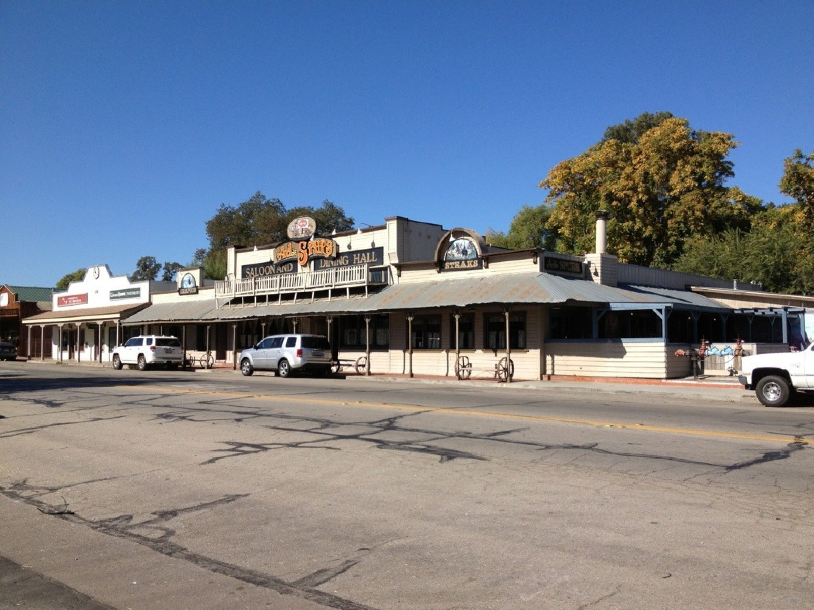
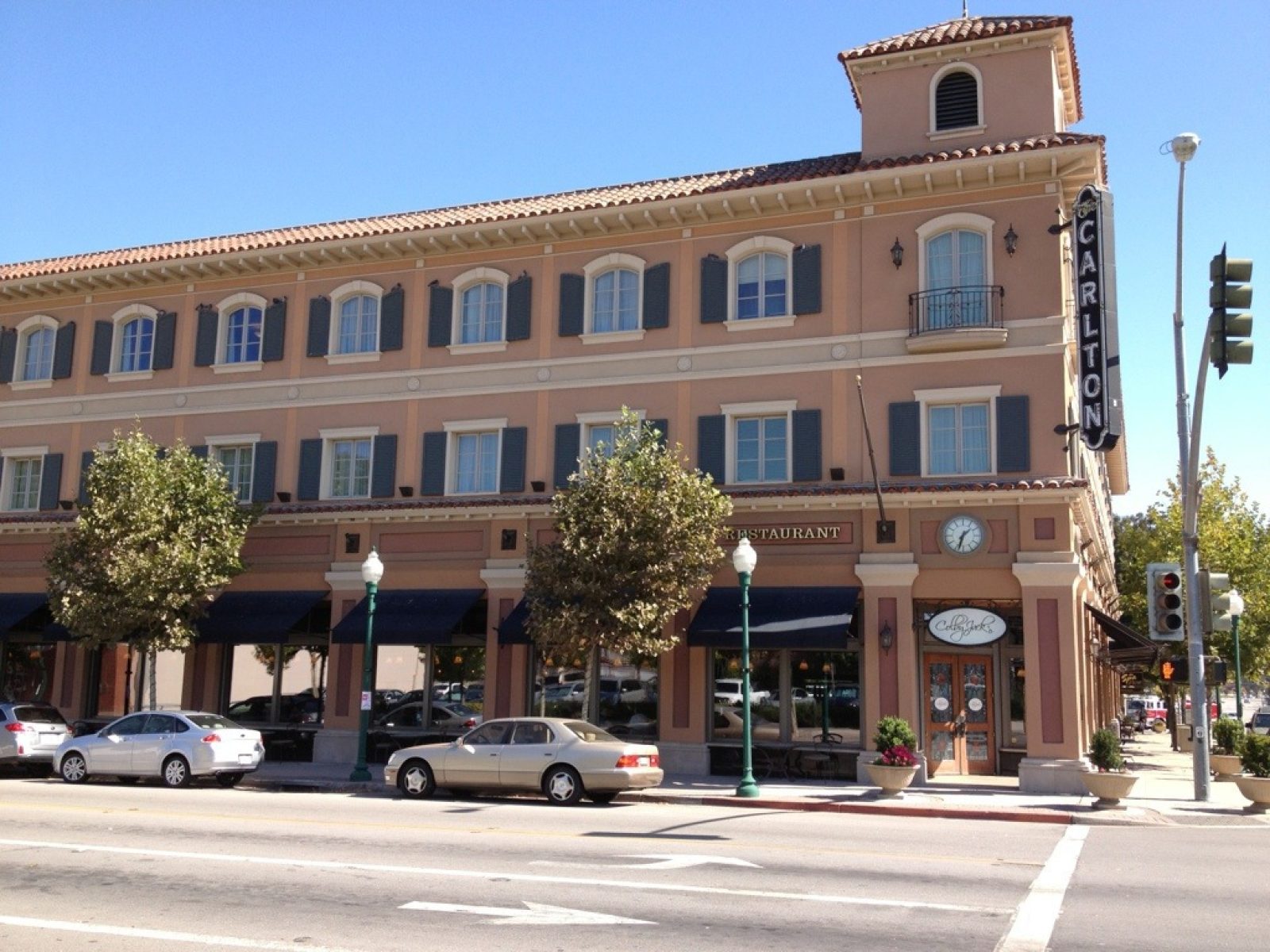
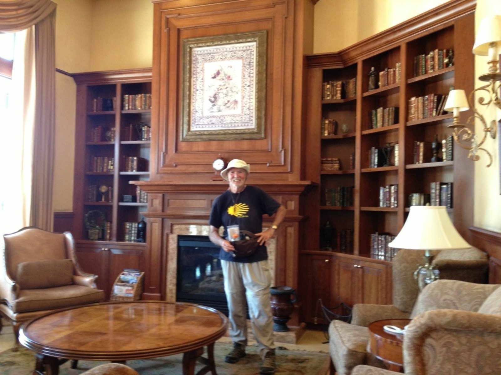
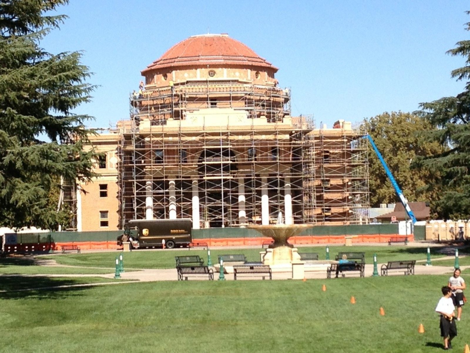
Today's trek opened my eyes to the three neighboring towns of Paso Robles, Templeton, and Atascadero that stretch over the 15.8 miles I walked. Dozens of car trips through this area had relegated these 3 towns to map markers and a place to rest and feast at the Atascadero In-N-Out--it was a convenient half-way stop. What I experienced today was remarkable. These towns have a breadth and depth far beyond my imagination--too little space to properly dignify. Paso Robles, of course, started as a rest stop for weary travelers between the missions, a place to recharge in the thermal baths (my story sans baths). Early settlers saw the value in the land to support cattle ranching, apple and almond orchards, and years later, vineyards. An 1864 spa hotel and the railroad coming in 1886, hugely propelled growth. Crocker (one of the San Francisco's Big Four) was to be the new town to the south, but it was named in honor of his son, Templeton. And Atascadero, has the most unbelievable history, being the brainchild of E.G. Lewis. He conceived it as a utopia for the America Woman's Republic (women's suffrage) while he gained from their subscription promotions for his magazine publishing empire. But after 1916, there's nothing to be found of their activities in Atascadero (the 19th amendment wasn't passed until 1920). Absolutely fascinating. I almost stayed at the historic Carlton Hilton for the night--couldn't wrangle a deal that comes close to my austere "Motel 6" good deals! Check out the picture in their lobby, as well as the one of the Atascadero City Hall (Italian Renaissance). I've also included a picture of a Templeton saloon--the town has a distinct western flavor. As a PS, I tried to invoke a shortcut south of Templeton. But I failed to be able to make the steep river bank (the Paso Robles Creek), so I crossed over on the RR bridge (still saved me several miles).
Day 26 - Mission San Miguel to Paso Robles
DAY 26 — Thursday, Oct 18, 2012
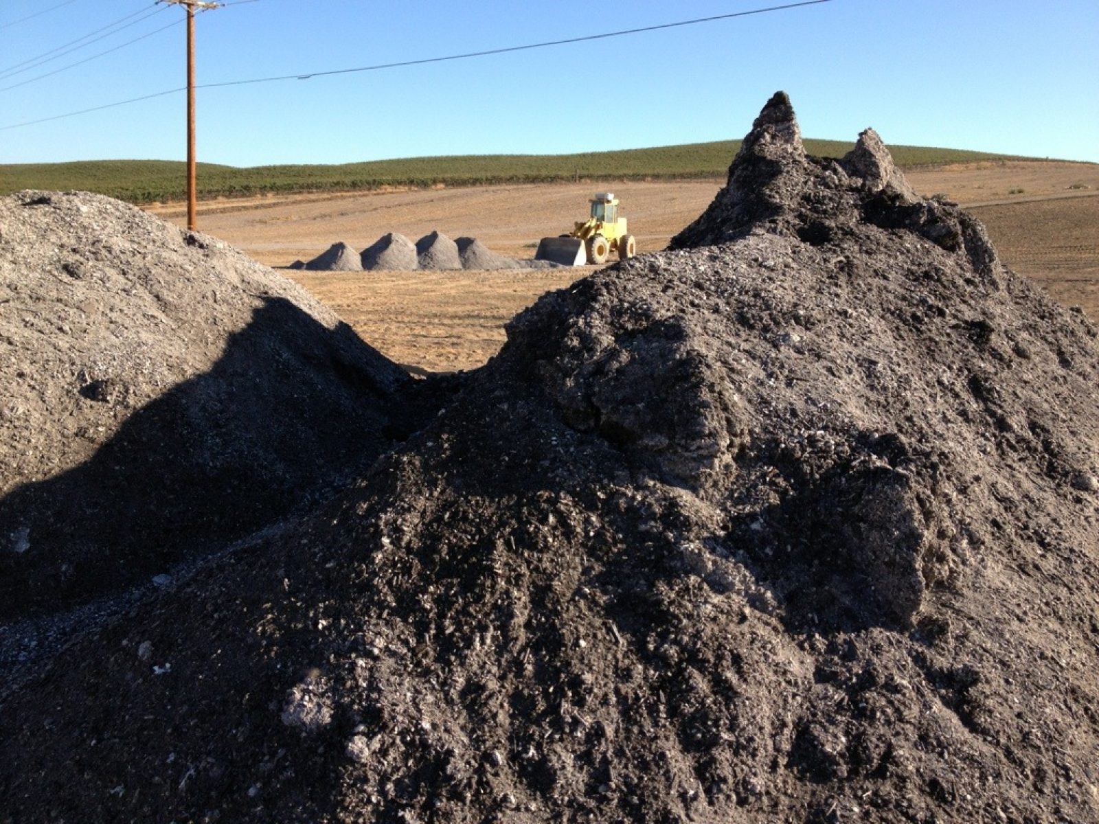
Shortest walk yet: 9.8 miles--feels like a down day. My trek paralleled the 101 to the east as it skirted vineyards and fields of grain. I saw 100s of acres being prepared to grow new vineyards where they hauled in tons of dirt/compost to kickstart Mother Nature in the wine business.
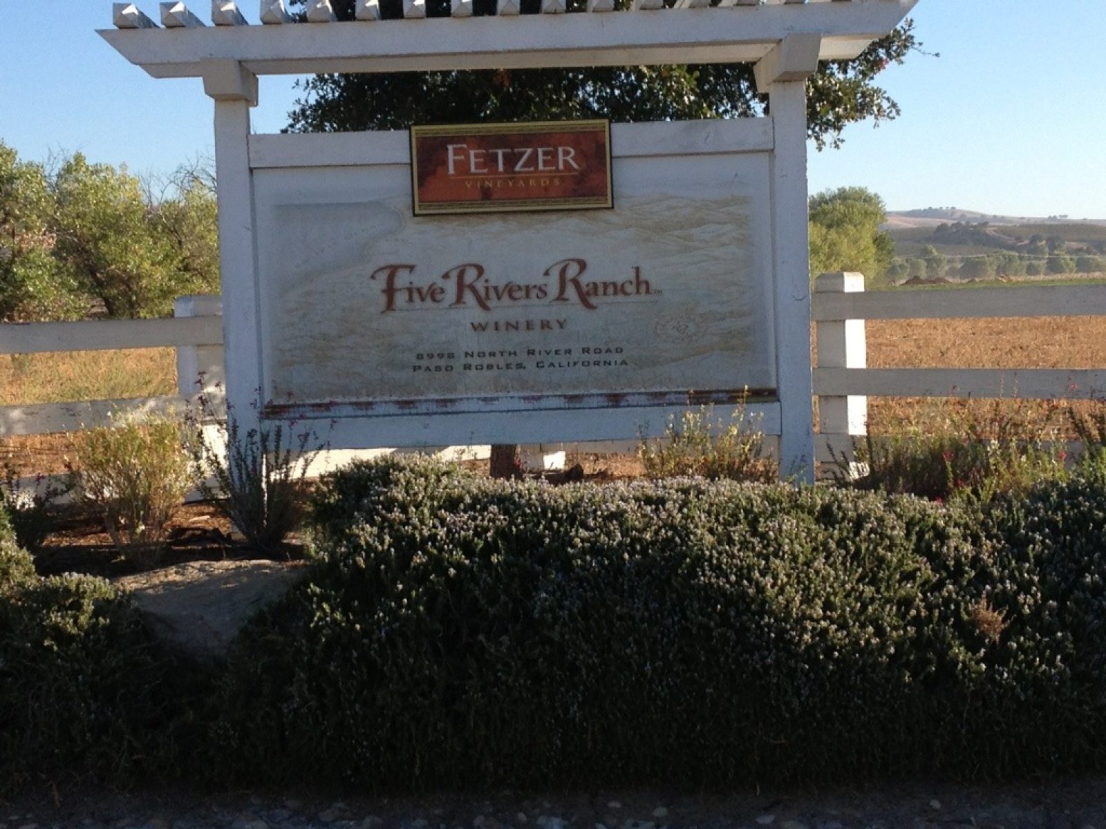
Trucks were busy hauling their harvested grapes and the scarecrow canons were keeping the birds at bay. As I passed the Paso Robles Fetzer winery (their main operation is up north between Ukiah and Healdsburg) it brought to mind that all of that brand was sold in 2011 to the Chilean company, Concha y Toro--a huge transaction. I guess they're still selling wine under the Fetzer brand. The operation here is very high volume!
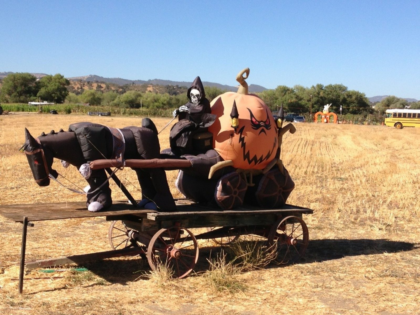
And signs of Halloween are everywhere!
Day 25 - Lake Nacimiento Resort to Mission San Miguel Arcangel
DAY 25 — Wednesday, Oct 17, 2012
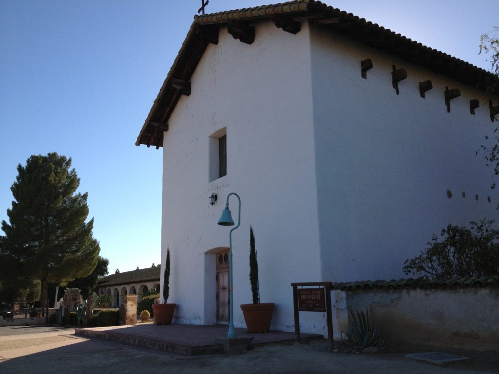
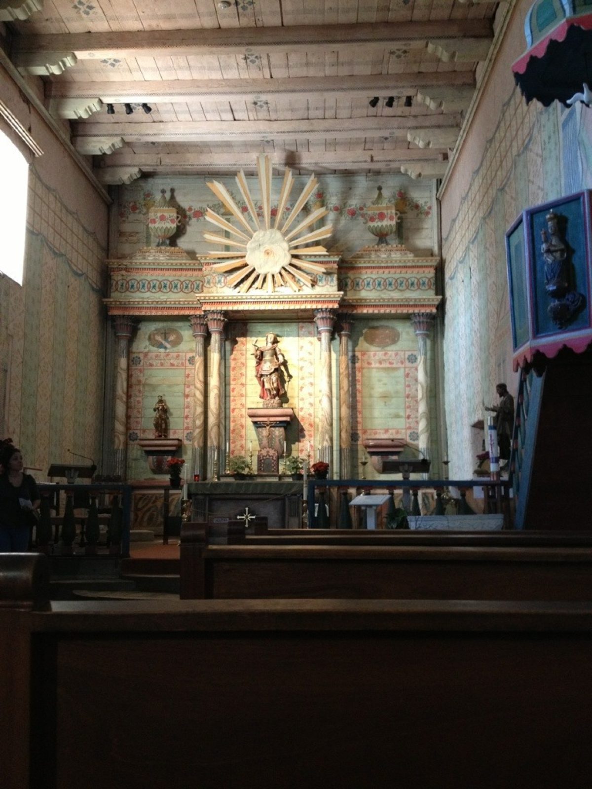
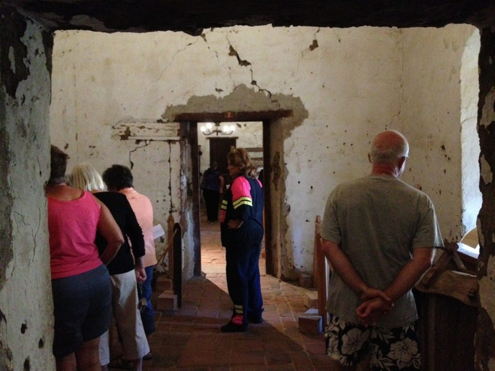
What a difference food makes!!!! Made the 18.3 mile walk plus a one mile ride through a construction zone as well as 2400 ft of climbing in weather that peaked near 90--all without a hitch. I saved a lot of the dinner that Eric and Shandi brought me last night for breakfast and also had coffee that they brought. It was like heaven. I was unstoppable this morning! Wow. The walk again passed over rolling hills spotted with oaks. For the last third, I left the Juan Bautista de Anza Trail and took San Marcos Road east until it ended at the 101--it basically skirts the southern border of Camp Roberts, a Calif. Army National Guard base. A number of wineries greeted me on San Marcos Road reminiscent of the earlier walks days ago. San Miguel Mission was established in 1797 basically to link the missions of San Antonio and San Luis Obispo. The mission church's interior is said to be one of the "best preserved" of all the missions! I visited their very informative museum and took the self-guided tour. The pictures give you some impressions of the mission. The original thick adobe walls are evident as you tour the various rooms.
Day 24 - Lake San Antonio Campsite to Lake Nacimiento Resort
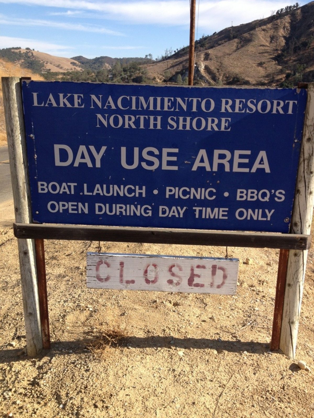
DAY 24 — Tuesday, Oct 16, 2012
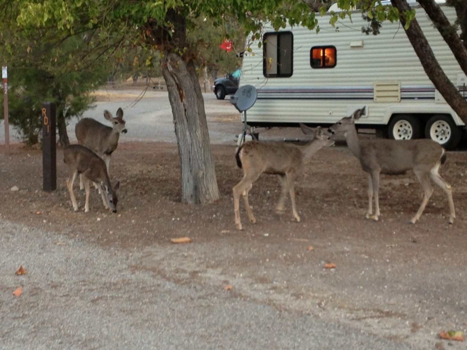
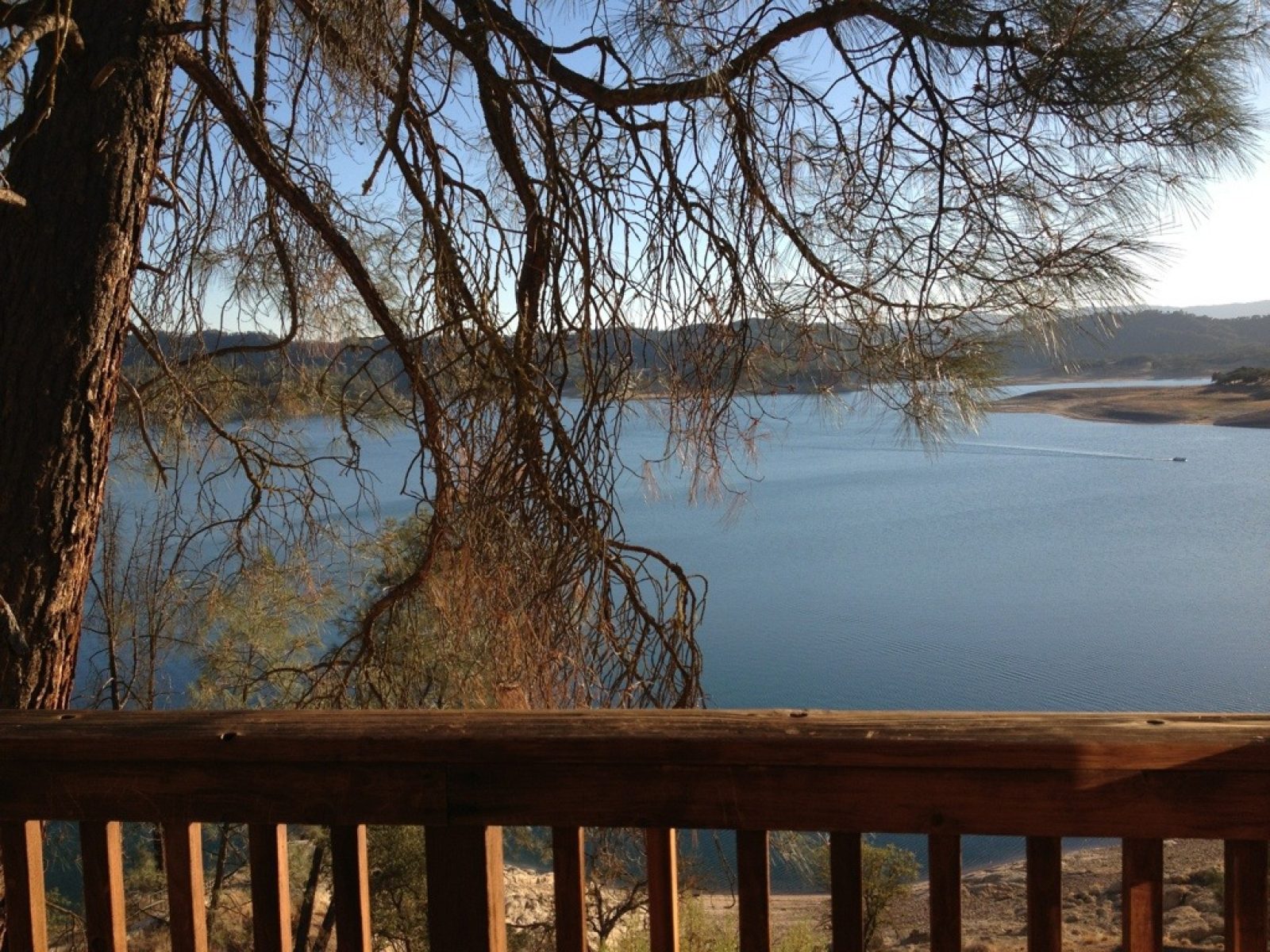
Today was one of highs and lows. Temperature was pushing 90; went up hill 2329 ft (according to my app. Gaia); only had some trail mix to eat since the store I was counting on was closed; and when I reached my destination and I saw the sign: CLOSED, I panicked inside (no food, no stores, no energy, but I did have another quart of water or so). So after regaining my wits, googling, etc. it turned out that the Nacimiento Resort was indeed not closed for the season and was ahead another mile (half of it uphill). HOWEVER, a lady at their store told me on the phone that they closed at 4:30! Needless to say, I didn't make it! Frantic calls at their gate caught someone who agreed work late and to give me a lodge (a real spoiler) and by now, the store and restaurant were closed. But as good fortune would have it, the manager of the restaurant was coming through the gate--not only did he ferry me around, but he and his lady friend fixed me a huge meal and delivered it a half hour later along with 3 quarts of Gatorade and water and power bars and coffee for tomorrow morning. It all nearly overwhelmed me! I'm counting my blessings. Part of the meal will be tomorrow's breakfast and I'll be in good shape for the 90 deg day 18 miles and the 11th mission. These are some favorite pics starting with a wakeup from the campground deer and ending with a shot from my lodge overlooking Lake Nacimiento.
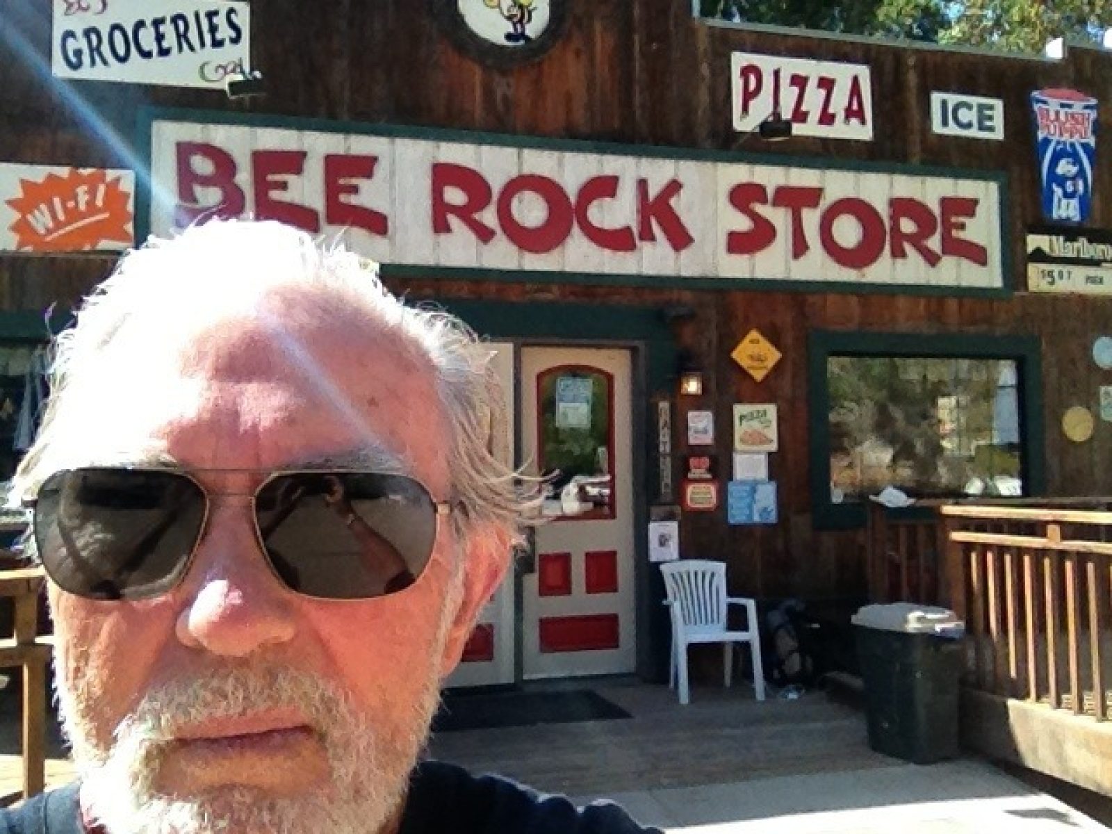
Day 24 - The Bee Rock Store
DAY 24 — Tuesday, Oct 16, 2012
You know how you count on something and then it doesn't materialize--what a disappointment! And so it was with the Bee Rock Store! Here is where I counted on some breakfast, water for the rest of the day, a nice cold drink midway through the trek, and a recharge for my buddy (iPhone). Closed, and in fact going out of business! It wasn't a total bust. I found water and an electric plug! The rest can wait another 4 hours.
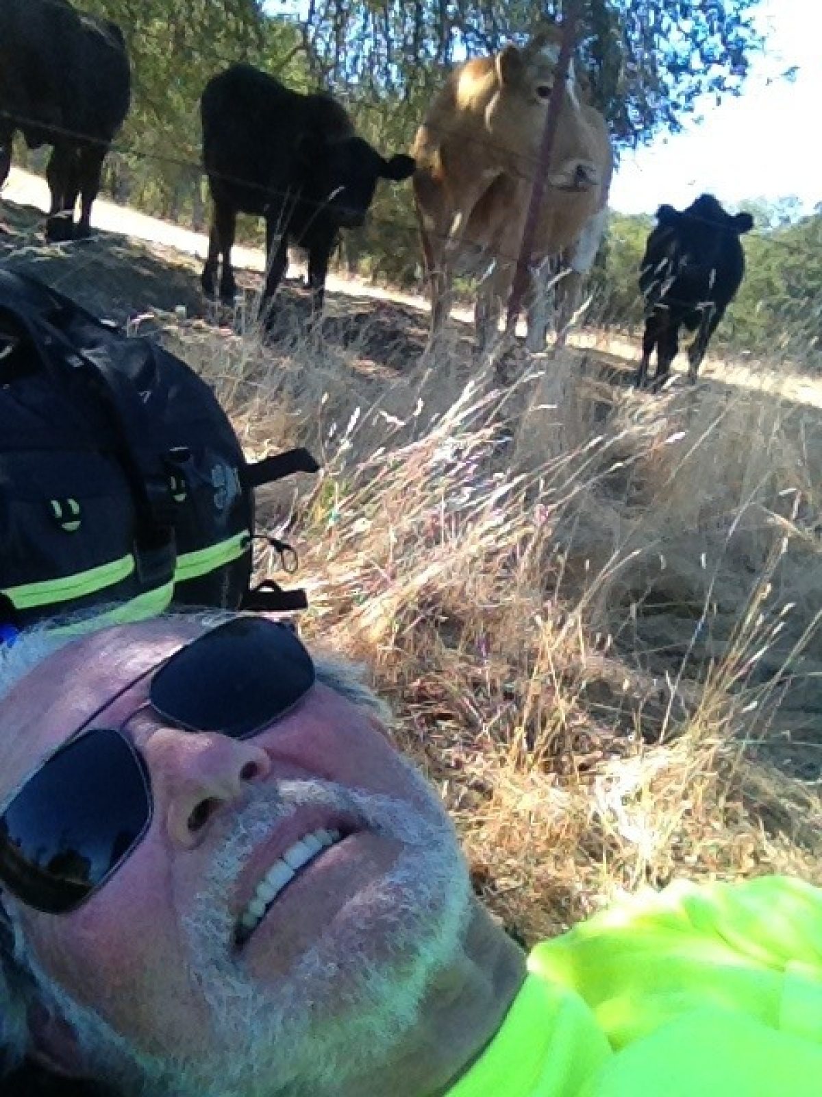
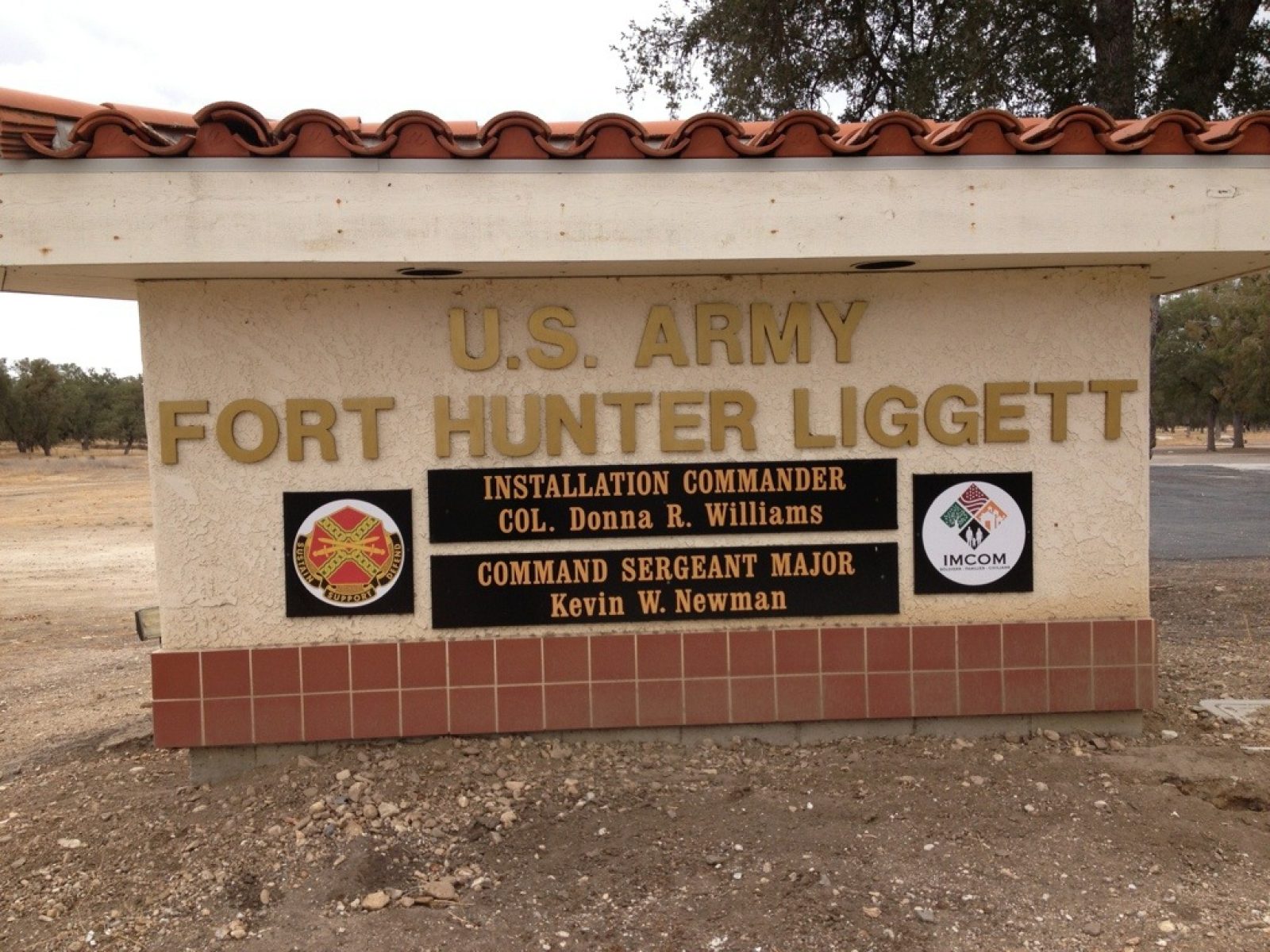
Day 23 - Fort Hunter Liggett Campground to San Antonio Lake
DAY 23 — Tuesday, Oct 16, 2012
This 23-mile day pushed me to the limit, but I also realized it would be one of the toughest on the route. Most of the day was passing Fort Hunter Liggett itself. The scenery has changed from the agricultural fields and vineyards still around King City to rolling hills of golden grain and majestic old oak trees providing shade for the cattle. I even befriended a bovine family during one of my rest stops--check out the pic.
As I left the camp before sunrise, I heard what sounded like the squealing of wild pigs and dogs who must have cornered them (or something else). Gunshots every where--definitely hunters' haven. FHL campground opens at 5am to issue hunting and fishing licenses!
I couldn't resist asking for a cup of coffee at the Lockwood Fire Station about six miles into the walk. They were extremely friendly giving me a much needed coffee and providing me a cell phone number in case I needed help and wanted to avoid 911. Temperatures were expected to rise--more today--and they wanted to make sure I had lots of water. Muy amiable! A few miles further, I found the Lockwood store and had a breakfast of sorts.
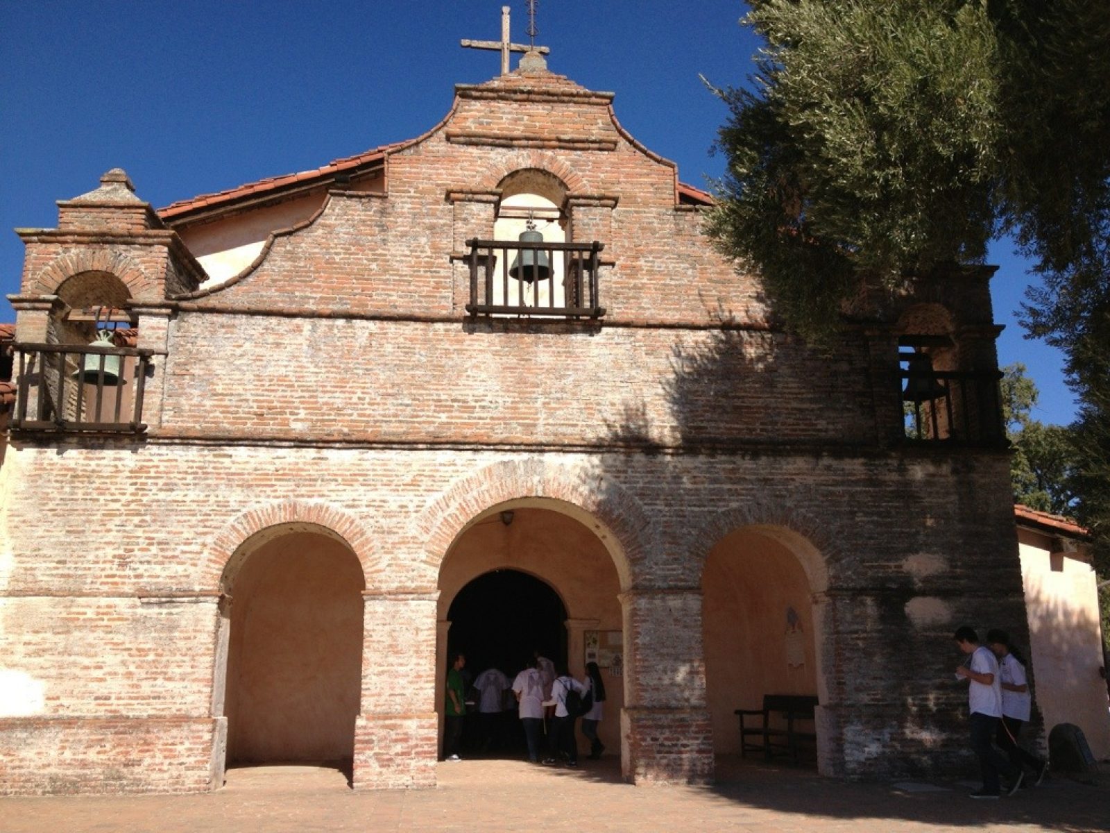
Day 22 - Fort Hunter Liggett Campground to Mission San Antonio and Return
DAY 22 — Sunday, Oct 14, 2012
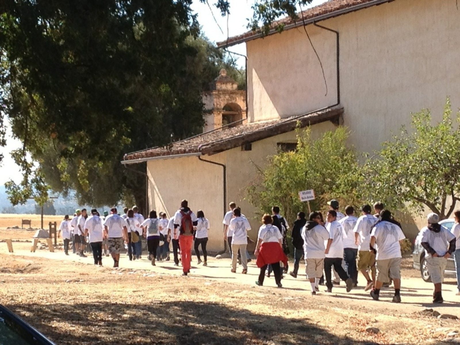
A short under 10- mile round trip brought me to Padre Serra's third California mission. Like the others, I see them all in two unique phases of struggles: pre- and post-secularization (1834). At first, all of them struggled simply to survive and fulfill their mission. After secularization, each has its own path leading them to their status today. In 1928, the Franciscans were invited to take back the mission. And in 1939/40 Hearst, who had preciously bought much of the mission lands as his cattle ranch, sold the land around the mission to the US Army for training our troops for WWII. Then in 1948-52 the mission was reconstructed with support from the Hearst Foundation. What's different here, is that unlike most other missions, there was no town that grew around. That makes for a different evolution. My visit coincided with a 600+ teenage Diocesan Youth Day sponsored by the Monterey Diocese. What a wonderful opportunity to strengthen their faith. The staff was most gracious: they gave me breakfast and let me fill up on water! I'm now set for tomorrow! My last comment: it's said that this is the only mission Father Serra would recognize!
Day 21 - King City to Ft Hunter Liggett
DAY 21 — Saturday, Oct 13, 2012
Made the 20 mile walk to find Ft Hunter Liggett campground very primitive; no water, food, or chance to recharge iPhone. Will go the 6 miles to Mission San Anton and return today, then off toward next mission tomorrow.